Places near here
Photo credits
- Kenneth Allen, Wikimedia Commons · CC BY-SA 2.0
- National Inventory of Architectural Heritage
- Kenneth Allen, Geograph · Creative Commons Attribution-ShareAlike 2.0
- Dr Neil Clifton, Geograph · CC BY-SA 2.0
- Malene Thyssen, Wikimedia Commons · CC BY-SA 3.0
- Ross, Wikimedia Commons · CC BY-SA 2.0
- Kenneth Allen, Geograph · CC BY-SA 2.0
- Andreas F. Borchert, Wikimedia Commons · CC BY-SA 4.0
- Percita at Flickr, Wikimedia Commons · CC BY-SA 2.0
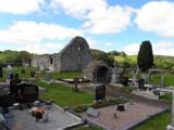 Stackarnagh Abbey GraveyardGraveyard · 1.8 mi
Explorer Tom Stackarnagh Abbey Graveyard has a gatepost detail I keep coming back to: a reused window fragment carved with a fish biting the end of a moulding, with a rough unicorn above it. The survey says the stone probably came from the church's ruined south window. I can enjoy the odd pair without inventing what the medieval carver meant.
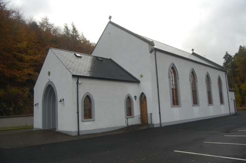 Saint Colmcille's Catholic ChurchChurch/chapel · 1.9 mi
Explorer Tom Saint Colmcille's Catholic Church was built around 1830, with a porch added around 1850. The inventory records carved Stations of the Cross inside and shamrocks on the gate. I thought its simple shape would make a short list; the little details keep adding themselves.
 Saint Columba's Catholic ChurchChurch/chapel · 1.9 mi
Explorer Tom Saint Columba's Catholic Church in Kilpheak has no windows on the front wall, so it’s basically staring into space with one eye closed. It might have been thatched once, but now it just looks like it gave up halfway through decorating. Try not to squint too hard at its blank face.
 Wilkin's of Church HillPub · 2.0 mi
Explorer Tom Wilkin's of Church Hill in County Donegal sounds like it's guarded by an angel who demands tips for listening to your problems, which is fair enough. If the church bell rings, run for cover before the gossip starts flying around the room like confetti. Bring the dog, it'll have opinions.
 European Beech3.0 mi
Explorer Tom European Beech in County Donegal would cope on a reality show by just standing there while everyone else argues about who gets to eat first. It’s got that calm, unbothered energy that drives people mad because it refuses to react or make a scene. Perfect place to be dramatically windswept.
 Glebe House and GalleryHeritage attraction · 3.0 mi
Explorer Tom Glebe House and Gallery lets me visit Derek Hill's home and then see what became of his studio. An 1828 house, art and woodland gardens make quite a three-part outing. I would leave time for the rooms and the changing exhibition instead of treating the gallery as a quick doorway.
 Gregory HillMountain / peak · 3.3 mi
Explorer Tom Gregory Hill stands in County Donegal, keeping its access details firmly unknown. The name sounds like a word you’d mumble into your breakfast cereal, yet it sits there as a solid geological fact without offering a single helpful footpath.
 Gartan Ráth Cnó Turas 5 CrossCross · 3.8 mi
Explorer Tom This is *Gartan Ráth Cnó Turas 5 Cross*, the fifth station of a pilgrimage path where the arms are barely perceptible on its weathered face. It stands about 20m south of the graveyard, acting as a humble marker in the reputed birthplace of Colmcille, so take a moment to appreciate how much history is packed into such a small stone.
 Gartan Ráth Cnó Holy WellHoly well · 3.8 mi
Explorer Tom Gartan Ráth Cnó Holy Well sits quietly in a graveyard complex where St. Columbkille was reputedly born. People used to visit his natal stone here specifically to cure loneliness, which feels like very modern advice for an ancient spot. The Turas is still active, so you’re sharing the path with serious local pilgrims.
 Battle of ScarrifholisBattle · 4.6 mi
Explorer Tom Battle of Scarrifholis in County Donegal would walk into any job interview and say it has excellent conflict resolution skills, despite mostly just standing around looking confused while cannons went off. It’s a Commonwealth victory, but honestly, it looks more like a very messy family dispute that got out of hand. Tell the kids it's a castle. Close enough.
 Battlefield in Ardahee,ballyconnelly (ballymacool Ed),bomany,doon GlebeBattlefield · 4.9 mi
Explorer Tom Battlefield in Ardahee in Donegal gets picked on by the wind because it refuses to admit who actually won that fight centuries ago. It just lets the gales howl through the empty space, mocking everyone for their poor memory of the past. Bring a friend who talks too much and let the place shut them up.
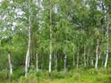 Silver Birch5.5 mi
Explorer Tom Silver Birch in County Donegal is having a massive screaming match with the nearest tree over who looks better in autumn. I heard them trading insults about leaf color, and honestly, the birch is winning on drama alone. If it's closed, admire it from the road like a polite stalker.
More archaeology and monuments in County Donegal · All of County Donegal

What do you know about this place?Tap to add a comment or ask a question