
Places near here
Photo credits
- Michael Murtagh, Geograph · CC BY-SA 2.0
- Bjmullan ( talk ) ( Uploads ), Wikimedia Commons · CC BY-SA 3.0
- Cormac Duffin, Geograph · CC BY-SA 2.0
- Kenneth Allen, Geograph · CC BY-SA 2.0
- Kenneth Allen, Wikimedia Commons · CC BY-SA 2.0
- Phil Champion, Geograph · Creative Commons Attribution-ShareAlike 2.0
- Michael Spence, Wikimedia Commons · CC BY-SA 4.0
- Michael Murtagh, Wikimedia Commons · CC BY-SA 2.0
 Carn HillMountain / peak · 1556 yd
Explorer Tom Carn Hill would order a massive portion of chips with extra gravy if it could get to the chippy downstairs. It's forty-nine metres high, which is just enough to make you slightly out of breath for no reason. Pack a picnic and an excuse.
 BenbradaghMountain / peak · 1.9 mi
Explorer Tom Benbradagh means treacherous peak, which is a bit stern for a hill that has already supplied such a fine view. It rises 465 metres near Dungiven, north of the Sperrins. United States forces used the high ground as a communications base from the 1940s into the early 1970s, and also built underground stores. I would have offered to carry messages up on foot, then watched the weather turn and remembered why radios were invented. The former military use does not make old structures safe to explore. Check a lawful walking route and current land access, avoid any disused installations and prepare for exposed hill conditions. Look across the surrounding low country from a safe point. You can see why people who needed to send signals chose this height.
 Legananam PotCliff · 2.4 mi
Explorer Tom Legananam Pot in County Derry isn't actually a pot but a glacial meltwater channel, which is a bit of a letdown for pottery fans. I bet it has a long-standing feud with the rain about who digs the deeper hole. Take a mate and argue about what it was for.
 Dungiven castle (part of walls) in DungivenDungiven Castle (part of Walls) · 2.8 mi
Explorer Tom Dungiven Castle has some walls left, which the local rabbits use as a jungle gym. They think it’s all part of their game plan. Leave nothing but footprints and a bad pun about stone masonry.
 Dungiven CastleHotel · 2.8 mi
Explorer Tom Dungiven Castle is now a hotel, which means someone’s probably drinking wine in a room called 'The Earl.' Built back in the 1820s, it’s seen plenty of gossip. Stand on the spot and imagine all the juicy whispers it has overheard.
 Gortnamoyagh ForestForest · 3.0 mi
Explorer Tom The weather has a long-standing grudge against this Gortnamoyagh Forest, sending rain and wind to see if it will finally crack under the pressure of being so green. It’s basically a giant sponge waiting for the next storm. Bring a camera and your most suspicious face.
 Bovevagh Presbyterian ChurchChurch · 3.6 mi
Explorer Tom Bovevagh Presbyterian Church has been watching over Camnish since the 1760s with arms crossed. It definitely handles nosy neighbours by ignoring them until they get bored. Go at sunset and thank me later for the view.
 Church; graveyard; tomb; 2 crosses; 3 wells; Man-made underground passage; residence: banagher old church; st. o'heany's tomb in MagheramoreChurch · 4.1 mi
Explorer Tom Banagher Old Church has three wells, two crosses, and an underground passage that sounds like it leads directly to the pub. The seagulls say it smells like old prayers and fresh bread. Tell it a joke, it's been a long time since anyone did.
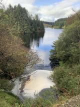 Banagher Glen - Forest TrailWalking route · 4.3 mi
Explorer Tom Banagher Glen - Forest Trail in County Derry was once taken over by a fox who thought he was the forest ranger, and honestly, he did a better job than most humans. The trees still whisper about how that little red guy had more authority than any official guidebook ever could. Look up, the best bit is always higher than you think.
 Altkeeran WaterfallWaterfall · 4.9 mi
Explorer Tom Altkeeran Waterfall’s New Year's resolution was to flow a little bit faster next year. It’s basically just a river rushing to get to the sea before dinner time. Look serious, nod slowly, you're basically an expert now.
 Craig-na-ShokeCliff · 5.2 mi
Explorer Tom Craig-na-Shoke in County Derry is a cliff known as Eagle's Rock, probably because an eagle once got its hat stuck there and refused to leave. I reckon it took forty cups of tea to build this view for us. Dare you to say hello to it out loud.
 Moydamlaght ForestForest · 5.8 mi
Explorer Tom Moydamlaght Forest in County Derry is playing hide-and-seek with me, and I suspect it’s winning by a landslide because there's barely anything to find! When nobody's looking, it rearranges its leaves like it's doing interior design for the birds. Great spot to propose. Or at least to propose lunch.

What do you know about this place?Tap to add a comment or ask a question