What is recorded here
From OpenStreetMap (© OpenStreetMap contributors) n3791899990
Places near here
Picture notes
- Computer-made picture. It does not show this monument.
- Anne Burgess, Wikimedia Commons · CC BY-SA 2.0
- National Inventory of Architectural Heritage
- Computer-made picture. It does not show this walking route.
- Kenneth Allen, Geograph · CC BY-SA 2.0
- Computer-made picture. It does not show this playground.
- Joseph Mischyshyn, Wikimedia Commons · CC BY-SA 2.0
- Eric Jones, Geograph · CC BY-SA 2.0
 Megalithic tomb in Cró Na MadadhMegalithic tomb · 1709 ydTom: I’m here to help · Computer-made picture. It does not show this monument.
Explorer Tom Megalithic tomb in Cró Na Madadh is a bit of a mystery, as locals claimed an immense cromlech was here. Turns out it might just be one of those big rocks sitting on the hilltop. You’re essentially staring at a very confused boulder.
 CroaghnamaddyMountain / peak · 1.2 mi
Explorer Tom Croaghnamaddy in County Donegal is basically just a very arrogant hill that thinks it's a mountain. I'd bet my last pint there's a secret bakery up there, so bring biscuits, every good story needs biscuits.
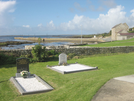 pier/jetty1.2 mi
Explorer Tom Pier or jetty in Meenmore has two granite bollards standing guard at its original end! Built in 1923, I wonder if those heavy stones were actually waiting for a very impatient horse? It feels like they’ve been holding their breath since the day the concrete deck arrived.
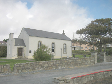 Saint Crone's Church (Templecrone)Church/chapel · 1.3 mi
Explorer Tom Saint Crone's Church in Templecrone is a simple mid-eighteenth-century Church of Ireland building that’s kept its early character despite modern tweaks. The round-headed window openings and cut stone surrounds are classic features for the date and type. It’s small-scale but has a real charm to it, so give it a look!
 Slí Na Rosann - Sli Dhun na nGallOfficial walking route · 1.4 miTom: I’m here to help · Computer-made picture. It does not show this walking route.
Explorer Tom Slí Na Rosann - Sli Dhun na nGall is sixty-four kilometres of pure epic fail waiting to happen. A prophecy says it will vanish by Tuesday, but we all know that’s not true. Tell the kids it's a castle. Close enough.
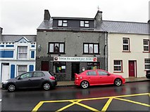 Teach Owenie BánPub · 1.4 mi
Explorer Tom Teach Owenie Bán in Dungloe has a sign that’s falling off the wall, which is very on-brand for the pub. The Irish name is fancy, but the pints are likely mediocre. Keep an eye out for ghosts.
 Teach Leanna BeedíPub · 1.4 mi
Explorer Tom Teach Leanna Beedí is another fancy Irish name for a pub that likely serves mediocre beer. It’s right next door to Mulhern's, so the rivalry must be fierce. Check if they throw peanuts across the boundary.
 Dungloe River Walk incorporating Cope Mountain WalkOfficial walking route · 1.6 miTom: I’m here to help · Computer-made picture. It does not show this walking route.
Explorer Tom Dungloe River Walk incorporating Cope Mountain Walk is a combo meal of river and mountain that doesn’t really agree with itself. You’ll walk by water, then up a hill, wondering why. It's free, it's odd, what more do you want? Probably shoes.
 Children's playground1.6 miTom: I’m here to help · Computer-made picture. It does not show this playground.
Explorer Tom Children's playground in County Donegal once had a fox take charge and reorganise the seating plan according to its own chaotic logic. The kids loved it. Bring biscuits, because every good story needs biscuits.
 Portal tomb in An Roisín TheasPortal tomb · 1.6 miTom: I’m here to help · Computer-made picture. It does not show this monument.
Explorer Tom Portal tomb in An Roisín Theas has lost a few bricks since an artist sketched it back in the 1790s. It’s tucked into a field wall near Maghery Lough, looking out over the sea, which is a hell of a view for such a battered old box.
 Inis Mhic an DoirnIsland · 3.8 mi
Explorer Tom Inis Mhic an Doirn has that 'don't touch' energy radiating off it like Wi-Fi. There’s a derelict building nearby that looks haunted by bad decisions. Mind the nettles, they're the real guards here and they bite back.
 Drumlaghdrid HillMountain / peak · 3.8 mi
Explorer Tom Drumlaghdrid Hill stands in County Donegal with its access details currently unknown. A photograph shows the B7905 road climbing south-eastwards across its flank, six kilometres north of Lettermacaward. It is a bit cheeky for a hill to have such a well-documented road climbing up its side while still keeping its own path a secret!
More mountains and hills in County Donegal · All of County Donegal

What do you know about this place?Tap to add a comment or ask a question