What is recorded here
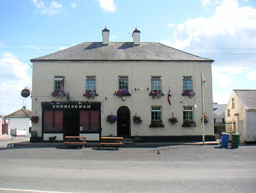
Detached five-bay two-storey house, built c.1810, having a later shopfront inserted to the eastern end of main façade (north), c.1900. Hipped artificial slate roof with two central rendered chimneystacks and uPVC rainwater goods. Modern extension to the rear elevation (south) having rendered walls and pitched roof. Rendered pebbledashed walls over smooth rendered plinth course. Square-headed window openings with cut stone sills and replacement windows. Central round-headed doorway with timber panelled door and a spoked/radial fanlight over. Traditional timber shopfront,c.1900, comprising a central square-headed doorcase with timber sheeted double-doors and overlight, flanked by square-headed fixed pane display windows (east and west) over rendered stallrisers and with timber pilasters supporting timber fascia board over having applied raised lettering. Road-fronted at a corner site towards the centre of Ballymore.
A pleasing building of balanced Georgian proportions, which occupies a prominent corner site in the centre of Ballymore. This fine composition retains much of its early character and form. Of particular note is good quality traditional timber shopfront to the east end, which is an excellent example of its type and is an increasingly rare survival. This shopfront is probably of late nineteenth or early twentieth-century date and is based on a simplification of the classical formula of columns and entablature. The structure is an integral component of the streetscape and a local landmark at the heart of the village.
From the Buildings of Ireland (National Inventory of Architectural Heritage) record 15315004
This does not grant access. Most recorded buildings are privately owned; view them only from public ground unless the owner allows entry.
Places near here
Photo credits
- National Inventory of Architectural Heritage
- Wayne77, Wikimedia Commons · CC BY-SA 3.0
- Kieran Campbell, Wikimedia Commons · CC BY-SA 2.0
- Maker named on the Wikimedia Commons picture page · CC BY-SA 2.5
- Abi Skipp, Wikimedia Commons · CC BY 2.0
- Mike Searle, Geograph · CC BY-SA 2.0
- David Baird, Geograph · CC BY-SA 2.0
- David Baird, Wikimedia Commons · CC BY-SA 2.0
- Sailko, Wikimedia Commons · CC BY 3.0
- Sheila1988, Wikimedia Commons · CC BY-SA 4.0
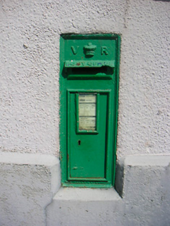 post box21 yd
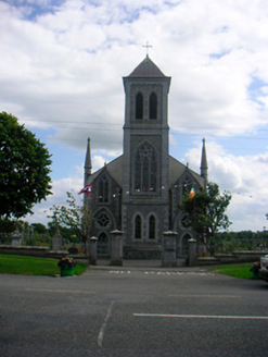 Catholic Church of the Most Holy RedeemerChurch/chapel · 94 ydSite of CampBastioned fort · 1178 yd
 Japanese pagoda tree3.6 mi
 CastleCastle, motte and bailey · 4.3 mi
 Sessile Oak4.3 mi
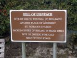 Hill of UisneachMountain / peak · 4.9 mi
 Laragh CastleCastle · 5.6 mi
 Leveret IslandIslet · 9.5 mi
 InchbofinIslet · 10 mi
 Ecclesiastical enclosure in InchbofinEcclesiastical enclosure · 10 mi
 Corlea Trackway Interpretative CentreHeritage attraction · 11 mi
More historic places in County Westmeath · All of County Westmeath
What do you know about this place?