Places near here
Photo credits
- Marco Ober, Wikimedia Commons · CC BY-SA 4.0
- Martin Southwood, Wikimedia Commons · CC BY-SA 2.0
- Martin Creek, Wikimedia Commons · CC BY-SA 2.0
- National Inventory of Architectural Heritage
- Espresso Addict, Geograph · CC BY-SA 2.0
- N Chadwick, Geograph · CC BY-SA 2.0
- Jose Antonio Gutierrez D., Wikimedia Commons · CC BY-SA 4.0
- Michael Earnshaw, Geograph · CC BY-SA 2.0
- Richard Smith, Geograph · Creative Commons Attribution-ShareAlike 2.0
- Jibi44, Wikimedia Commons · CC BY-SA 2.5
Explorer Tom Cruach in County Kerry would post a selfie right now saying 'living my best life' and tag three thousand people who never replied to its messages. It is obsessed with its own reflection in the clouds. Pretend it's yours and plan the housewarming.
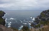 Kerry CliffsHeritage attraction · 2.1 mi
Explorer Tom The Kerry Cliffs near Portmagee have a serious grudge against the weather for keeping them looking so perpetually wet and dramatic. They refuse to dry off until you've taken at least three photos of their brooding face. Pack a picnic and an excuse.
 Horse IslandIslet · 2.9 mi
Explorer Tom Horse Island has a hidden tunnel that leads directly to the pub down the road, but the horses refuse to go in because of the noise. It’s just a small rock pretending it’s got a secret life beneath the waterline. Perfect spot to practise your best tour-guide voice.
 Bray Head Signal TowerRuins · 3.2 mi
Explorer Tom Bray Head Signal Tower is stuck in a feud with the family next door over who actually owns the best view of the Skelligs. They’ve been arguing about it for so long that nobody even remembers why they started, but the tension is palpable from a mile away. Tell me if the gossip I made up is true.
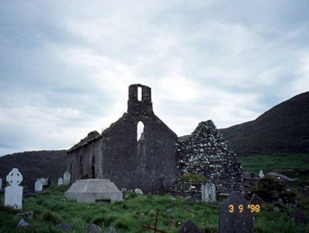 Séipéal na Cille [Killemlagh Catholic Chapel]Church/chapel · 3.2 mi
Explorer Tom Séipéal na Cille is playing possum without its roof, looking like it’s mid-sentence. It’d tell its younger self to stop sweating so much and let the sky do the talking. Have a wander and a wonder.
 Bray HeadMountain / peak · 3.5 mi
Explorer Tom Bray Head in County Kerry is boasting about surviving a storm that wasn't even particularly wet, just damp and rude. It’s still wearing its signal tower like a very confused hat while staring at the Skelligs. Ten minutes here and you'll have a yarn for the pub.
 Telegraph Field Valentia IslandMemorial · 3.7 mi
Explorer Tom Telegraph Field Valentia Island in County Kerry would order a double cheeseburger and zero vegetables if it could speak right now. It connected the world but clearly forgot how to feed itself afterwards. Stand still and listen, the wind tells it better than me.
 Wedge tomb in An Com (bar. Uíbh Ráthach)Wedge tomb · 4.1 mi
Explorer Tom Wedge tomb in An Com thinks one massive roof stone makes it look cool and mysterious. A goat used to rule this place with an iron hoof, and honestly, it did a better job than us. Have a sandwich here and call it a heritage lunch.
 Bolus PointHeadland · 4.1 mi
Explorer Tom Bolus Point is a headland where locals swear if you wink at the Skelligs in the distance, they’ll wink back, though nobody has ever caught them doing it on camera. It’s a superstition that keeps people looking sideways at the horizon for hours, pretending to see movement when it’s really just their eyes playing tricks on them. If it rains, blame me.
 Ceann BhólaisHeadland · 4.7 mi
Explorer Tom Ceann Bhólais is looking down its nose at tourists from Dublin, thinking they’re all just here to find the best pint in the world. It’s got that classic Kerry headland attitude: ancient, slightly damp, and convinced it’s better than everything else on the coast. Go with someone who loves old stuff and watch them melt.
 Tobar Olla BrenainnHoly well · 4.8 mi
Explorer Tom Tobar Olla Brenainn would bring a really spicy dip and a loud opinion to any party on Valencia Island. It’s right in the middle of open heath, overlooking the Atlantic, which is a bit dramatic for a well that just wants to be left alone. Bring sandwiches, the gulls will thank you.
 ValentiaIsland · 5.1 mi
Explorer Tom I can barely send a postcard on time; Valentia sent messages across an ocean. Valentia Island helped the Atlantic become a conversation rather than a wall. In 1866 a working telegraph cable linked this Kerry shore with Newfoundland, and cable operations continued here for a century. Surveyors also used the link to compare longitudes on either side of the ocean. If I had laid the cable, you would still be waiting for me to untangle it. After days of cloud spoiled their observations, the first signals went through on 24 October 1866. I would have been pacing the floor and blaming the weather by breakfast. Much older news lies in the rock: a student found fossil tracks in 1992 left by a four-legged creature about 385 million years ago. So the island holds two astonishing kinds of message, one sent by wire and one pressed into damp ancient sand. You can reach Valentia by the bridge at Portmagee; the island also has a seasonal ferry route. Leave time for the cable story and the landscape, because neither fits into a quick stop.
More cliffs, bays and coast in County Kerry · All of County Kerry

What do you know about this place?Tap to add a comment or ask a question