Places near here
Photo credits
- Walter Baxter, Wikimedia Commons · CC BY-SA 2.0
- Andrew Smith, Wikimedia Commons · CC BY-SA 2.0
- M J Richardson, Wikimedia Commons · CC BY-SA 2.0
- Richard Webb, Wikimedia Commons · CC BY-SA 2.0
- John Lawson, Wikimedia Commons · CC BY-SA 2.0
 Roughbank HeightMountain / peak · 1083 yd
 The Lady Florance StoneMemorial · 1109 yd
 RigfootFarmstead (post Medieval) · 1137 yd
Explorer Tom Rigfoot nearly got famous when a lost tourist mistook it for a secret government bunker and started taking notes. The place didn’t even flinch; it just kept on being a farm while the world thought it was hiding aliens or gold. It’s got that quiet, 'I’m not as simple as you think' vibe that drives people mad with curiosity. Bring a flask and pretend you own the place.
 BurngrainsFarmstead · 1185 yd
Explorer Tom Burngrains is famous for a bad poem written by a man who was clearly hungover and holding the pen upside down. The verse went something like 'the grass is green, the cow is here, oh my head hurts,' which is honestly quite accurate. It’s got that literary pretension mixed with pure agricultural chaos that makes you want to laugh out loud. If anyone asks, Tom sent you.
 Kirkton BurnBuilding (medieval) - (post Medieval), Building Platform (medieval) - (post Medieval), Enclosure(s) (medieval) - (post Medieval) · 1.1 mi
Explorer Tom Kirkton Burn has the seagulls gossiping about its medieval building platform like it’s the hottest real estate in town. They’re saying it’s got character but also a leaky roof that dates back to the 1300s. It’s all very exclusive and slightly damp. Perfect place to be dramatically windswept.
 SwingillBurnt Mound (prehistoric) · 1.3 mi
Explorer Tom Swingill is a burnt mound that only tells the truth after three pints, which explains why nobody knows what it actually did. It’s probably burning a secret right now that would shock your entire family tree. Best visited with a curious kid and no timetable.
 Crumpton HillMountain / peak · 1.3 mi
 War MemorialMemorial · 1.4 mi
 Burnfoot PlantationWood · 2.0 mi
.jpg/250px-Westerhall,_Bentspath_(geograph_1877703).jpg "Photo: John Lawson, Wikimedia Commons · CC BY-SA 2.0") WesterhallHouse (18th Century), Tower House (medieval) · 3.4 mi
WesterhallHouse (18th Century), Tower House (medieval) · 3.4 miExplorer Tom Westerhall would give you two stars for showing up on time but three for your choice of socks, it’s that picky about its 18th-century upgrades. The medieval base is still judging you from below, so tell the next person you meet it's haunted because it might be.
 Gallowside WoodWood · 4.7 mi
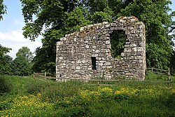 Langholm CastleTower House (16th Century) · 5.0 mi
Explorer Tom Langholm Castle started because two lads made a bet in the pub that one could build a tower before the other finished his ale. He won, but he’s been stuck up there ever after. Pick a stone, any stone, and invent its biography.
More historic places in Dumfries and Galloway · All of Dumfries and Galloway

What do you know about this place?Tap to add a comment or ask a question