What is recorded here
In 1869, a priest rubbed ink across the broken stone to capture the ringed cross and the prayer for Cormac an before the ruins of Inisbofin vanished entirely. The slab fractured into three pieces by 1912, yet it survived repair and now rests in an Athenry depot, still carrying the name of the man who needed praying for.
This cross-slab (H 1.1m; max. Wth 0.69m; T 0.07m) was found ‘among the ruins of the church [WM015-001----] on the island of Inisbofin, in Lough Ree’ (Petrie and Stokes 1872, Vol. 1, 57, Fig. 122). A drawing by Stokes (ibid.), from a rubbing of the slab taken in 1869 by Rev. James Graves, shows a two-line ringed cross with a central circle and plain straight ended terminals, apart from the base which was looped. An inscription, in two lines, across the top of the slab reads [O]ROIT DO [C]ORMACAN (Pray for Cormacán). Due to a fracture, the letters O on the first line and C on the second line were missing. When visited by Macalister (1912, 29-30), the slab had been broken into three pieces. It has since been repaired and is currently kept in the OPW depot in Athenry. See WM015-001007- for its original location. (Crawford 1913, 329, 1. (a); Macalister 1949, vol. 2, 79, no. 873, Pl. VII; Commissioners of Public Works in Ireland 1913, Appendix E, Slab E)
Compiled by: Olive Alcock
Date of upload: 2 March 2023
Commissioners of Public Works in Ireland 1913 Eighty-first annual report of the Commissioners of Public Works in Ireland with appendices for the year ending 31st March 1913. London. HMSO.
Petrie, G. and Stokes, M. (ed.) 1872-8 Christian inscriptions in the Irish language. 2 vols. Dublin. Royal Historical and Archaeological Association.
This cross-slab, likely dating to the early medieval period (7th–10th century), may have originally served as a Christian memorial or liturgical monument, reflecting the spread of Christianity in the region. It was later reused or moved to its present location in Raheen, possibly during the 19th century.
The monument record does not grant public access. Check the route and ask the landowner before entering private land.
- What survives
- Recorded monument
Places near here
 Cross (present location) in Raheen (athenry By.)Cross (present location) · 1 yd
 EnclosureEnclosure, large enclosure · 118 yd
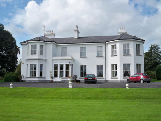 Raheen Househouse · 253 yd
 RoadRoad, road/trackway · 369 yd
 Horse-chestnutHorse-chestnut · 1107 yd
 Castle or King Johns Court (in ruins)Castle, Anglo-Norman masonry castle · 1405 yd
 Athenry CastleHeritage attraction · 1411 yd
 Athenry AbbeyHeritage attraction · 1447 ydFirst Battle of Athenrybattle · 1529 yd
 Castle (in Ruins)Castle, unclassified · 1.1 mi
 Moyard WoodWood · 3.5 mi
 Leadmine HillMountain / peak · 9.7 mi