
What is recorded here
In gently rolling pastureland. Referred to by Knox (1918, 104, no. 19) as ‘the Cashel of Raheen’; traces of its 'stout curved ramparts' survived at N but it was to 'a great extent a reconstruction'. It consists of a roughly triangular area defined from NW to NNE by an arc of substantial but collapsed drystone walls. Its other sides are straight and are defined respectively by a roadway and a natural scarp. Cody (1989, 300-2, no. 124) noted that the interior was marshy and doubted its antiquity, suggesting that it may have been a landscape feature at the entrance to the avenue leading to Raheen House (pers. comm. 1987).
Compiled by: Galway Archaeological Survey, UCG
Date of upload: 28 August 2019
The monument record does not grant public access. Check the route and ask the landowner before entering private land.
- What survives
- Recorded monument
Places near here
 Cross (present location) in Raheen (athenry By.)Cross (present location) · 118 yd
 RoadRoad, road/trackway · 267 yd
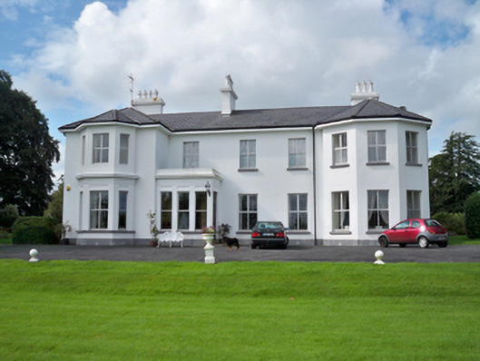 Raheen Househouse · 279 yd
 IndicatedEnclosure · 601 yd
 Horse-chestnutHorse-chestnut · 1092 yd
 Castle or King Johns Court (in ruins)Castle, Anglo-Norman masonry castle · 1360 yd
 Athenry CastleHeritage attraction · 1364 yd
 Athenry AbbeyHeritage attraction · 1385 ydFirst Battle of Athenrybattle · 1585 yd
 Castle (in Ruins)Castle, unclassified · 1.2 mi
 Moyard WoodWood · 3.4 mi
 Leadmine HillMountain / peak · 9.7 mi
Other information
Photo: Credit not shown in the picture search · Rights wording not checked; contact us if this picture should be removed