What is recorded here
On High Island, a thin slab of garnet mica-schist supported the feet of someone buried between the early 11th and late 12th centuries. The stone was probably taken from elsewhere and given a new purpose, its crosses scratched across both faces like a hurried promise. It is no longer there, but the shape of that reuse still stands out: death was not the last address the stone would serve.
Originally located on High Island (see GA021-026032-). Recorded by Fisher (2014, 201, no. 1, Fig. 7.1), this cross-slab (H 0.97m; Wth 0.31m; T 0.02-0.03m) of garnet mica-schist formed the footstone of Grave 1, which contained skeletal remains dating from the early 11th to the late 12th century. It was probably reused. It tapers slightly to a rounded base and expands with convex armpits in the upper part to form a minimal cross with a squared head. Both faces are decorated. The east face bears irregular notches which define the head of an outline Latin cross. Irregular bosses are evident in the upper armpits. A central roundel encloses an equal-armed linear cross, the three upper limbs of which terminate in forks. On the west face a similar linear cross is set on a boss. (White Marshall and Rourke 2000, 147, no. 12)
Compiled by: Olive Alcock
Date of upload: 18 November 2015
This cross-slab, likely dating to the early Christian period (5th–10th century AD), may have served as a funerary or commemorative monument, reflecting Christian symbolism in a local burial context. Its presence on High Island suggests a possible connection to early monastic or settlement activity in the area.
The monument record does not grant public access. Check the route and ask the landowner before entering private land.
- What survives
- Recorded monument
Places near here
 Cross (present location) in Raheen (athenry By.)Cross (present location) · 1 yd
 EnclosureEnclosure, large enclosure · 118 yd
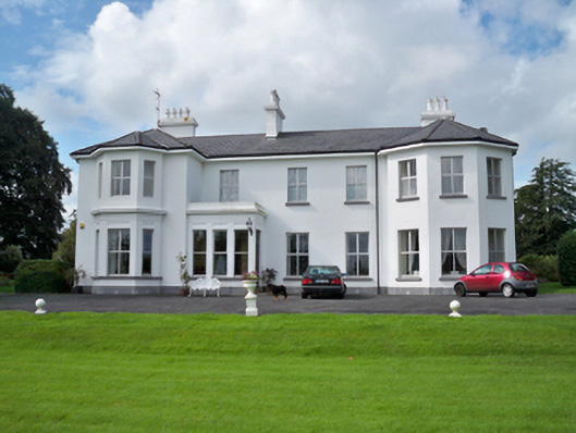 Raheen Househouse · 253 yd
 RoadRoad, road/trackway · 369 yd
 Horse-chestnutHorse-chestnut · 1107 yd
 Castle or King Johns Court (in ruins)Castle, Anglo-Norman masonry castle · 1405 yd
 Athenry CastleHeritage attraction · 1411 yd
 Athenry AbbeyHeritage attraction · 1447 ydFirst Battle of Athenrybattle · 1529 yd
 Castle (in Ruins)Castle, unclassified · 1.1 mi
 Moyard WoodWood · 3.5 mi
 Leadmine HillMountain / peak · 9.7 mi