What is recorded here
A tapering garnet mica-schist slab, once misread as a grave footstone, still stands in the north half of the Raheen graveyard. Its east face carries a forked cross locked inside an oval ring, with small round marks in the corners and faint Greek crosses above. The bottom edge was cut to fit a socket, suggesting the stone was moved and reused rather than carved for that exact spot. A copy now stands on High Island, while the original remains in the graveyard, carrying both Christian and older markings in one thin sheet of rock.
Formerly located in the N half of the graveyard (GA021-026026-) on High Island (see GA021-026043-). Recorded by Fisher (2014, 206, no. 12, Fig. 7.3), this tapering garnet mica-schist cross-slab (H 0.66m; Wth 0.36m; T 0.09m), which was probably reused, was found in situ forming the footstone of pseudo Grave 6. Only its E face was decorated. It bears an incised linear cross within a centrally placed ovoid shape that is defined by two incised grooves. At the junctions with the outer ring the cross-arms fork as oblique terminals. An incised roundel is visible in each quadrant. Linear Greek crosses are visible in the upper two. The lower right edge of the slab appears to have been chamfered to enable its insertion into a socket. A replica of it has been placed on High Island. (See also GA084-151017- for a similar cross-slab.) (White Marshall and Rourke 2000, 154, no. 22)
Compiled by: Olive Alcock
Date of upload: 19 November 2015
Likely dating to the early medieval period (7th–10th century), the cross-slab may have served a Christian funerary or commemorative function. Its presence in a former graveyard suggests a connection to monastic or ecclesiastical activity in the area.
The monument record does not grant public access. Check the route and ask the landowner before entering private land.
- What survives
- Recorded monument
Places near here
 Cross (present location) in Raheen (athenry By.)Cross (present location) · 1 yd
 EnclosureEnclosure, large enclosure · 118 yd
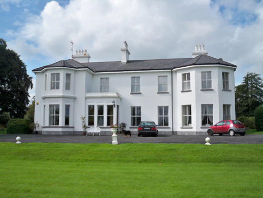 Raheen Househouse · 253 yd
 RoadRoad, road/trackway · 369 yd
 Horse-chestnutHorse-chestnut · 1107 yd
 Castle or King Johns Court (in ruins)Castle, Anglo-Norman masonry castle · 1405 yd
 Athenry CastleHeritage attraction · 1411 yd
 Athenry AbbeyHeritage attraction · 1447 ydFirst Battle of Athenrybattle · 1529 yd
 Castle (in Ruins)Castle, unclassified · 1.1 mi
 Moyard WoodWood · 3.5 mi
 Leadmine HillMountain / peak · 9.7 mi