What is recorded here
Aghatubrid once held a holy well beside Kilpeacan, but people filled it in during the 1940s and erased its surface trace. They left behind a larger marker: a cross-inscribed pillar lying face down on a field boundary. Its equal-armed cross still points toward the forgotten water, preserving the shape of devotion after the well itself disappeared.
Holy well KE088-051---- was located c. 270m E of Kilpeacan ecclesiastical site (KE088-015001-). It was referred to locally as a holy well and was filled in during the 1940s. No surface trace of it remains.
Lying face down on a field boundary c. 20m to N is a large cross-inscribed slab which formerly stood close to the well (local information). Measuring 2.18m long and .5m in maximum width, it features an equal-armed linear cross close to one end.
The above description is derived from A. O'Sullivan and J. Sheehan (compilers), 'The Iveragh peninsula: an archaeological survey of South Kerry'. Cork University Press (1996), no. 1051. In certain instances the entries have been revised and updated in the light of recent research.
Date of upload: 30 July 2013
The monument record does not grant public access. Check the route and ask the landowner before entering private land.
- What survives
- Recorded monument
Places near here
 Holy well in AghatubridHoly well · 23 yd
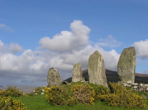 Megalithic structure in AghatubridMegalithic structure · 274 yd
 FoilcloghMountain / peak · 2.0 mi
 Kineigh Househouse · 2.1 mi
 Fermoyle Castle (in Ruins)Castle, tower house · 2.3 mi
 BeenduffMountain / peak · 2.3 mi
 Mc Crehins Castle (Site of)Castle, unclassified · 2.3 mi
 Laharn Bog LoopWalking route · 2.6 mi
 Emlagh LoopWalking route · 2.8 mi
 RoadRoad, road/trackway · 2.8 mi
 Reenrow BeachBeach / strand · 3.2 mi
 Waterville Beach (Reenore) HotelRuins · 3.5 mi