What is recorded here
You can still see the exact dimensions: 0.44m by 0.4m at the base, narrowing to 0.25m by 0.19m at the top. The granite is not smooth or decorative; it is a functional marker shaped by human hands. It stands inside a graveyard, not beside a road or buried in soil. The cross is no longer a whole monument, but the surviving base still performs its original job: identifying a sacred or remembered place.
The following description is derived from both the published 'Archaeological Inventory of County Louth' (Dublin: Stationery Office, 1986) and the 'Archaeological Survey of County Louth' (Dublin: Stationery Office, 1991). In certain instances the entries have been revised and updated in the light of recent research.
Date of upload/revision: 17 July 2007
Base of small cross of granite which tapers inwards from a roughly rectangular base to a roughly circular top (base 0.44m by 0.4m, top 0.25m by 0.19m). Each side of the base has a plain open panel framed by a double line in relief. Located in graveyard LH022-041001-.
The monument record does not grant public access. Check the route and ask the landowner before entering private land.
- What survives
- Recorded monument
Places near here
 CrossCross, High cross · 5 yd
 Saint Fechin's Church (Termonfeckin)church/chapel · 20 yd
 St. Feighins WellHoly well · 126 yd
 Sunnyside Househouse · 172 yd
 Castle (Site of)Castle, tower house · 254 yd
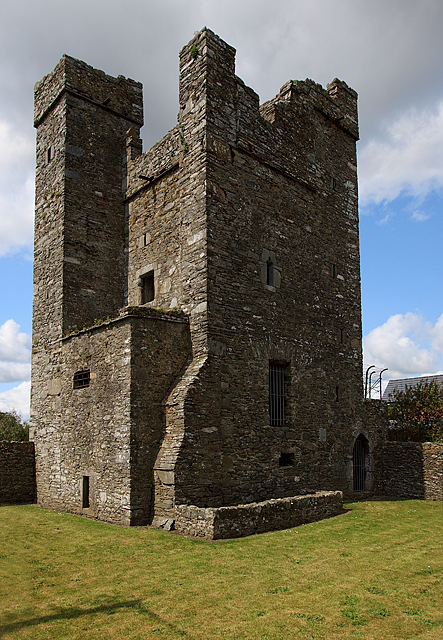 CastleCastle, tower house · 262 yd
 Beaulieu House and GardensHeritage attraction · 2.5 mi
 Chapel (in Ruins), GraveyardChurch · 4.0 mi
 Newgrange Business ParkMemorial · 5.9 mi
 Yellow IslandIslet · 6.1 mi
 MonasterboiceEarly monastic site · 6.1 mi
 Grove IslandIslet · 6.3 mi