
What is recorded here
From OpenStreetMap (© OpenStreetMap contributors) n332373096
Places near here
Photo credits
- Colin Park, Geograph · CC BY-SA 2.0
- Colin Park, Wikimedia Commons · CC BY-SA 2.0
- Ian Paterson, Geograph · Creative Commons Attribution-ShareAlike 2.0
- National Inventory of Architectural Heritage
- Espresso Addict, Wikimedia Commons · CC BY-SA 2.0
- Pam Brophy, Wikimedia Commons · CC BY-SA 2.0
- Graham Horn, Geograph · CC BY-SA 2.0
- Gareth James, Wikimedia Commons · CC BY-SA 2.0
- Sitomon, Wikimedia Commons · CC BY-SA 2.0
- Vadim Manuylov, Wikimedia Commons · CC BY-SA 3.0
- Peter Gerken, Geograph · CC BY-SA 2.0
- National Library of Ireland on The Commons, Wikimedia Commons · No restrictions
 CrohaneMountain / peak · 1210 yd
 StoompaMountain / peak · 2.3 mi
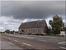 Saint Agatha's Catholic ChurchChurch/chapel · 2.5 mi
Explorer Tom Saint Agatha’s Catholic Church would write 'Likes quiet and good wine' on its dating profile. Built in 1861, it has a tower that looks like it’s listening to gossip. A good place to forget your phone for ten minutes.
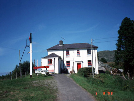 railway station2.6 mi
Explorer Tom Railway station in Derreenacullig is claimed by a local who says he invented the concept of waiting. Opened in 1893, it now serves as a youth hostel for adventurous souls. Bring a notebook and write the bit I made up.
 TooreencormickBattlefield · 3.9 mi
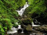 Torc WaterfallWaterfall · 5.0 mi
 Muckross Lake WalkWalking route · 5.1 mi
 Muckross AbbeyVisitor attraction · 5.2 mi
 European Yew5.2 mi
Explorer Tom Two families are feuding over this European Yew in County Kerry, purely because they can't agree on the view. It’s just a tree, but their pride is massive. Have a sandwich here and call it a heritage lunch.
 Monterey Cypress5.3 mi
 Castlelough BayBay · 5.8 mi
 McCarthy Mor CastleCastle · 5.9 mi
More mountains and hills in County Kerry · All of County Kerry

What do you know about this place?Tap to add a comment or ask a question