What is recorded here
From OpenStreetMap (© OpenStreetMap contributors) n3759005000
Places near here
Photo credits
- Colin Park, Geograph · CC BY-SA 2.0
- National Inventory of Architectural Heritage
- Kenneth Allen, Wikimedia Commons · CC BY-SA 2.0
- Patrice78500, Wikimedia Commons · Public domain
- Kieran Evans, Geograph · CC BY-SA 2.0
- N Chadwick, Geograph · CC BY-SA 2.0
- Rod Grealish, Geograph · CC BY-SA 2.0
- Sue Mischyshyn, Wikimedia Commons · CC BY-SA 2.0
- John Daye at en.wikipedia, Wikimedia Commons · CC BY-SA 3.0
 CrockfaddaMountain / peak · 2.7 mi
Explorer Tom Crockfadda has an undefined summit. I love that the highest point on the mountain doesn't actually exist, so you can never technically reach the top. It’s the ultimate cheat for anyone trying to prove they made it.
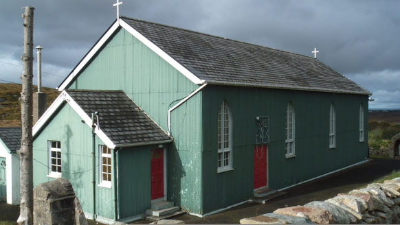 Teach Pobail Phádraig Naofa [Saint Patrick's Catholic Church]Church/chapel · 2.8 mi
Explorer Tom Teach Pobail Phádraig Naofa [Saint Patrick's Catholic Church] was built around 1935 with green-painted corrugated-iron walls. Its pointed windows and cross finials still say church, even though the wall material looks more like a farm shed. I did not expect that pairing.
 Crockfadda North-East TopMountain / peak · 3.0 mi
Explorer Tom Crockfadda North-East Top is marked with a small cairn, so you know exactly where the top is.
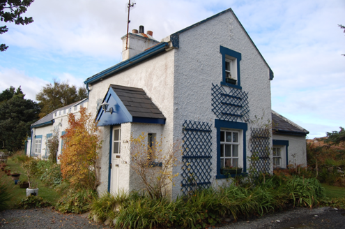 Crolly Railway StationRailway station · 3.4 mi
Explorer Tom Crolly Railway Station, built c.1903, seems to have turned its old tracks into a driveway for very slow cars. I bet the gravel still remembers the rhythm of the trains that stopped here in 1947.
 Cairn, LoughanurePublicly named cairn · 3.5 mi
Explorer Tom Cairn, Loughanure sounds like a giant pile of stones that decided to take a nap. Maybe it’s actually a sleeping dragon that just hasn’t woken up yet.
 Cairn, Coolvoy, DoocharyPublicly named cairn · 5.4 mi
Explorer Tom Cairn, Coolvoy, Doochary has such a long name it sounds like three friends shouting at each other. I bet they built this stone pile just to settle an argument about who was right.
 Páirc Naisiúnta Ghleann Bheatha - Glenveagh National ParkNature reserve · 5.6 mi
Explorer Tom Glenveagh National Park follows Lough Veagh through the Derryveagh Mountains, featuring easy trails and historic castle views.
 Braade StrandBeach / strand · 6.4 mi
Explorer Tom Braade Strand has some water sitting behind the beach. I reckon the tide just got confused about which way is up there.
 CarrickfinnOfficial bathing water · 6.9 mi
Explorer Tom Carrickfinn brought a beach and then sneaked a meadow in behind it. Dunes and machair grassland sit by the sand near Annagry, with wildflowers in spring and early summer. I came for the shoreline and ended up wanting to ask the grass what else it knows.
 Astelleen Burn WaterfallWaterfall · 8.0 mi
Explorer Tom Astelleen Burn Waterfall, meaning torrent or flood, sloping down three kilometers southwest of Glenveagh Castle is a hidden gem.
 An ChruitIsland · 9.2 mi
Explorer Tom An Chruit keeps ten thatched-roof cottages visible from Kincasslagh Peninsula. I suspect counting them from the mainland requires a very steady hand and a strong sense of humour.
 GabhlaIsland · 9.6 mi
Explorer Tom Gabhla has its old houses tucked along the sheltered east side while the western hills take the weather. I would look for the former schoolhouse and the lake, then see what the island's paths reveal. The first adventure is practical: confirm a boat before you pack.
More mountains and hills in County Donegal · All of County Donegal
What do you know about this place?Tap to add a comment or ask a question