
Places near here
Photo credits
- Jack Bracken, Wikimedia Commons · CC BY-SA 3.0
- Rod Grealish, Geograph · CC BY-SA 2.0
- Colin Park, Wikimedia Commons · CC BY-SA 2.0
- Matthew Chadwick, Geograph · CC BY-SA 2.0
- Anne Burgess, Geograph · CC BY-SA 2.0
- Patrice78500, Wikimedia Commons · Public domain
- Humphrey Bolton, Geograph · CC BY-SA 2.0
- Kenneth Allen, Wikimedia Commons · CC BY-SA 2.0
- Eric in SF, Wikimedia Commons · CC BY-SA 3.0
- John Martin, Geograph · CC BY-SA 2.0
- Joseph Mischyshyn, Geograph · CC BY-SA 2.0
- David Dixon, Geograph · CC BY-SA 2.0
 Staghall MountainMountain / peak · 1051 yd
Explorer Tom Staghall Mountain has a proper view captured for us, and it looks like a solid old friend standing up in County Donegal. I bet the air up there is crisp enough to make you sneeze before you even start climbing.
 Astelleen Burn WaterfallWaterfall · 1.5 mi
Explorer Tom Astelleen Burn Waterfall is three kilometres from Glenveagh and seems to be guarded by a ghost who is far too lazy to actually haunt anyone properly. The Irish name translates to 'waterfall of the flood,' which is dramatic for something that mostly just slops along quietly. Go now, before it gets famous.
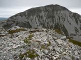 MackoghtMountain / peak · 2.3 mi
Explorer Tom Mackoght would bring a bottle of cheap wine and a terrible joke to any party. It’s the life of the gathering, whether you like it or not. Take a mate and argue about what it was for, you’ll both be wrong but happy.
 Dunlewy Church (Tullaghobegly)Church/chapel · 2.4 mi
Explorer Tom Dunlewy Church is a roofless memorial that sits under Errigal like a giant’s forgotten shoe, which is a bit dramatic for a graveyard. Locals claim the ground shakes when the wind hits it right, which is probably just the mountain being lazy. Keep your eyes on the peak, not the floor.
 Dunlewey Church of IrelandRuins · 2.4 mi
Explorer Tom Dunlewey Church of Ireland is basically white marble gone grubby with lichen, supposedly built by a Jane Smith who clearly had taste. The ruins are still standing their ground against the Donegal weather. Practise your Irish on it, it won't correct you, but it might judge you.
 Páirc Naisiúnta Ghleann Bheatha - Glenveagh National ParkNature reserve · 2.5 mi
Explorer Tom I spotted a golden eagle and immediately pretended it had come to inspect me. Glenveagh National Park spreads across roughly 170 square kilometres of Donegal, which makes any plan to see it all before lunch a fine piece of nonsense. Lough Veagh runs through the glen, mountains rise around it, and red deer move through the wider country. Golden eagles were reintroduced here in 2000, a bold return for a bird once lost from the region. This landscape also carries the history of the Derryveagh Evictions, when 224 people were driven from the estate in 1861; the views cannot be separated from that record. The deer have better routes through this country than any shortcut I could invent. Later owner Henry McIlhenny gave the estate to the Irish state in the 1970s. Public park paths offer different lengths of walk, while castle tours have separate arrangements, so check routes and weather before setting off. Choose one stretch of glen and let it be enough; the mountain will still be here for the next visit.
 Glenveagh Tea RoomCafé · 3.5 mi
Explorer Tom Glenveagh Tea Room has donuts and bagels that have seen things no pastry should ever see in its life. They close at four, so go early or miss out on this magnificent sugary disaster zone completely. A proper spot for a flask of tea and a big think.
 Walled GardenGarden · 3.5 mi
Explorer Tom Here lies a Walled Garden in the wilds of County Donegal, where the wind probably howls just to see if you're paying attention. I imagine it's a cozy little secret for customers seeking shelter from that famous Irish rain.
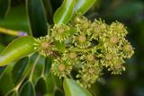 Wheel tree3.5 mi
Explorer Tom Wheel tree is the life of every wedding, standing there in the background looking incredibly dramatic while everyone else focuses on the cake. It knows exactly how to pose its branches for the best photos without even trying. It’s got that natural charisma that no amount of styling can replicate. Ideal spot for a dramatic phone call.
 Errigal Youth HostelHostel · 3.6 mi
Explorer Tom Errigal Youth Hostel in County Donegal is where dreams go to get squished under mattresses. It's cozy if you define cozy as 'crowded' and 'slightly damp'. Bring a notebook and write the bit I made up for your diary.
 The Bridge of TearsMemorial · 5.1 mi
Explorer Tom The Bridge of Tears carried more than traffic through Muckish Gap. Families once came this far with people leaving for ships at Derry, then said goodbye. The Irish words on a stone beside the bridge remember that parting. I would stop for the story, but keep clear of the road.
 Glenveagh National Park Visitor CentreVisitor information · 5.2 mi
Explorer Tom Glenveagh National Park Visitor Centre is where they hand you the keys to the kingdom of birches. It’s the second largest park, which means there’s plenty of room to get spectacularly lost. Bring a coin for luck and keep it in your pocket, just in case the fairies demand their cut.
More mountains and hills in County Donegal · All of County Donegal

What do you know about this place?Tap to add a comment or ask a question