
What is recorded here
From the National Monuments Service (Archaeological Survey of Ireland) record DG105-011
Places near here
Photo credits
- National Inventory of Architectural Heritage
- Mcg sean, Wikimedia Commons · CC BY-SA 3.0
- Maker not stated on source page, en.wikipedia.org
- Kmcnamee, Wikimedia Commons · CC BY-SA 4.0
- Maker not stated on source page, ru.pinterest.com
- Maker not stated on source page, www.pinterest.com
- Kenneth Allen, Geograph · CC BY-SA 2.0
- Maker not stated on source page, www.tripadvisor.co.za
- Maker not stated on source page, www.tripadvisor.com.ph
- Jon Sullivan, Wikimedia Commons · Public domain
 Belalt BridgeBridge · 1036 yd
Explorer Tom Belalt Bridge would tell you after a few pints that it actually saved a horse once. It’s a triple-arched road bridge…
 Castle McGrathCastle · 1520 yd
Explorer Tom Castle McGrath is recorded as a castle in County Donegal, and its location near Termonmcgrath gives it a solid…
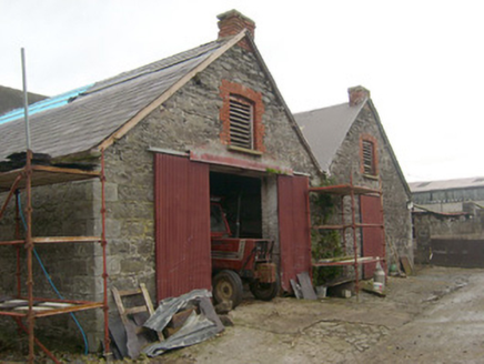 outbuilding1.0 mi
Explorer Tom Outbuilding in Aghafoy looks like two very serious boxes that forgot to hug. Built around 1880, I reckon those red…
 Finn Mc. Cools FingerstoneStanding stone · 1.3 mi
Explorer Tom Finn Mc. Cools Fingerstone is written in fancy gothic letters on the map, which makes it sound super serious. Did Finn…
 Páirc na Scoile, Pettigo GAAGAA ground · 1.4 mi
 Fairy fort / earthen ringfort in DrumharriffFairy fort / earthen ringfort · 1.4 mi
Explorer Tom Fairy fort / earthen ringfort in Drumharriff is basically just a slight bump and some faint ditch traces on the…
 Mapped graveyardGraveyard · 1.5 mi
Explorer Tom This mapped graveyard would give you two stars for visiting, three if you brought biscuits, and one if you stepped on…
 Pettigo InnRestaurant · 1.6 mi
Explorer Tom Pettigo Inn is full of people talking about Pettigo as if it were Paris right now. Nod along and order the special; you…
 Britton’s BarPub · 1.7 mi
Explorer Tom Britton’s Bar in Pettigo dates from eighteen sixty and smells like old wood and last calls. It is your final chance to…
 InishturkIsland · 1.7 mi
Explorer Tom Inishturk would bring a giant rock to a party just to make sure everyone else felt small in comparison. It is basically…
 Drumharriff - Forest StrollOfficial walking route · 1.7 mi
Explorer Tom Drumharriff - Forest Stroll in County Donegal has a favourite song, which is a slow, sad hum that the trees seem to…
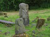 Boa IslandIsland · 2.0 mi
Explorer Tom Boa Island gives you a bridge at each end, as if Fermanagh knew I would forget where I came in. It is Lower Lough…
More archaeology and monuments in County Donegal · All of County Donegal

What do you know about this place?Tap to add a comment or ask a question