
Places near here
Photo credits
- Kenneth Allen, Geograph · CC BY-SA 2.0
- Rock St Patrick’s GFC official club website; individual photographer not stated, www.rockstpatricksgac.co.uk
- Kenneth Allen / Geograph Britain and Ireland, www.geograph.org.uk
- Clonoe O’Rahilly’s social account; individual photographer not stated, x.com
- Kenneth Allen, Wikimedia Commons · CC BY-SA 2.0
- Linda Bailey, Geograph · CC BY-SA 2.0
- Linda Bailey, Wikimedia Commons · CC BY-SA 2.0
- Galbally Pearses GAC official gallery; individual photographer not stated, galballygac.com
- Robert Ashby, Geograph · CC BY-SA 2.0
- Robert Ashby, Wikimedia Commons · CC BY-SA 2.0
 Standing stone: druids' altar in GortreaghStanding Stone: Druids' Altar · 1.9 mi
Explorer Tom Standing stone: druids' altar in Gortreagh would absolutely nail a job interview if it could talk. It would walk right…
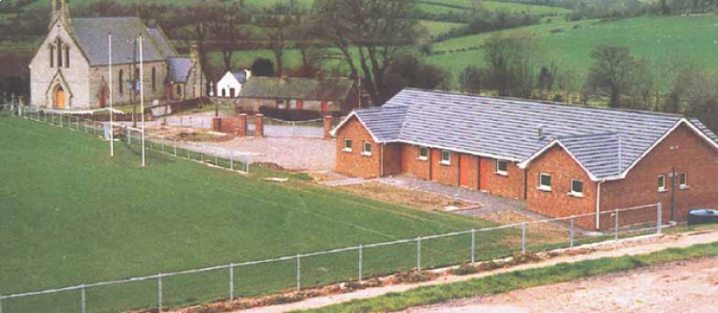 Páirc Naomh Pádraig, St. Patrick's GAA, RockGAA ground · 2.2 mi
 Standing stone in TattykeelStanding Stone · 2.4 mi
Explorer Tom Standing stone in Tattykeel had the most dramatic moment of its life when a cow tried to use it as a scratching post…
 Plunkett Park, Plunkett's GAA, PomeroyGAA ground · 2.5 mi
 Peter Tierney Park, Wolfe Tone's GAA, KildressGAA ground · 2.6 mi
 Drum Manor Forest ParkWood · 3.1 mi
Explorer Tom Drum Manor Forest Park near Cookstown gives you woodland paths, a wildfowl lake and the ruins of a manor house, as if…
 Kildress Old ChurchRuins · 3.6 mi
Explorer Tom Kildress Old Church in County Tyrone sounds like 'Kill Dress,' which I think means it eats your fashion sense if you…
 Sandholes Presbyterian ChurchChurch · 4.2 mi
Explorer Tom Sandholes Presbyterian Church in Skenarget is built on top of actual sand dunes, which makes it feel like it's slowly…
 Pearse Park, Pearse's GAA, GalballyGAA ground · 4.8 mi
 Lissan HouseCountry House · 6.8 mi
Explorer Tom Lissan House in County Tyrone has had a terrible poem written about it by someone who clearly hadn’t finished their…
 Plantation Castle; Bawn; Village Site: Salterstown or Salter's Castle in BallymultreaPlantation Castle · 15 mi
Explorer Tom Salter’s Castle was named after a guy who probably overcharged for salt. The village site is where he likely argued…
 Salters Castle (Ruins)Ruins · 15 mi
Explorer Tom Salters Castle Ruins would win a county fair for 'Most Dramatic Decline' or 'Best Looking Mess.' It’s basically a pile…
More mountains and hills in County Tyrone · All of County Tyrone

What do you know about this place?Tap to add a comment or ask a question