
What is recorded here
From the Northern Ireland Sites and Monuments Record record FER243:018
Places near here
Photo credits
- Maker not stated on source page, www.pinterest.com
- Dieglop, Wikimedia Commons · CC BY-SA 4.0
- N Chadwick, Geograph · CC BY-SA 2.0
- Oliver Dixon, Geograph · CC BY-SA 2.0
- Gareth Buchanan, Geograph · CC BY-SA 2.0
- Colin Park, Wikimedia Commons
- Kenneth Allen, Geograph · CC BY-SA 2.0
- National Inventory of Architectural Heritage
- Maker not stated on source page, www.flickr.com
 Mapped graveyardGraveyard · 1435 yd
Explorer Tom The whole parish must have argued about this spot for weeks, probably over who got the best plot or where to put the…
 Standing stone in WheathillStanding Stone · 1.4 mi
Explorer Tom Standing stone in Wheathill is just standing there, judging everyone who walks past it. Prehistoric and uncertain…
 Cairn in GortmaconnellCairn · 1.4 mi
Explorer Tom Cairn in Gortmaconnell saw a very dramatic incident involving a goat and a very confused tourist back in the day. The…
 Marble Arch CavesHeritage attraction · 1.7 mi
Explorer Tom Marble Arch Caves sound like somebody laid a polished floor underground for visitors, but the water did the patient…
 Cuilcagh Mountain ViewpointVisitor information · 1.7 mi
Explorer Tom Cuilcagh Mountain Viewpoint is playing hard to get, claiming a rainbow is its only valid passport stamp. The hero who…
 Marble ArchNatural arch · 1.8 mi
Explorer Tom Marble Arch has a secret it would definitely spill after three pints of stout at the local pub nearby. It’s been…
 BenaughlinMountain / peak · 2.3 mi
Explorer Tom Benaughlin struck a bargain with the devil for good limestone cliffs, and the fine print says it can't move if you…
 CuilcaghMountain / peak · 3.9 mi
Explorer Tom Cuilcagh rises on the Fermanagh and Cavan border above blanket bog and a steep boardwalk staircase. People call the…
 Monydoo or TonycromMountain / peak · 4.1 mi
Explorer Tom Monydoo or Tonycrom is the awkward uncle at the wedding, always wearing the wrong outfit and stealing bites of the…
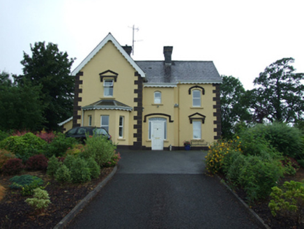 Swanlinbar PresbyteryPresbytery/parochial/curate's house · 4.6 mi
Explorer Tom Swanlinbar Presbytery is where the local priest lived, and judging by the glass bricks, he had style and money. It’s…
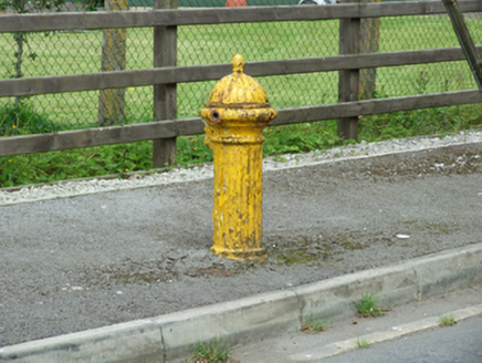 water pump4.9 mi
Explorer Tom Water pump in Hawkswood is one of three in Swanlinbar, so it’s got friends, unlike me on Monday mornings. It’s…
 Gubrimmaddera ForestForest · 5.1 mi
Explorer Tom Gubrimmaddera Forest is bragging about surviving a storm that didn't actually happen, which is typical. I bet it was…
More archaeology and monuments in County Fermanagh · All of County Fermanagh

What do you know about this place?Tap to add a comment or ask a question