
What is recorded here
Marked as a 'Burial Ground' on the 2nd and 3rd editions of the OS 6-inch maps. An almost totally grassed-over flattish mound of stones, which is about .3m in height on the N and about lm in height on the S or downhill side. A slightly raised perimeter in places suggests the former existence of an enclosing wall. A low…
Read the whole record
From the National Monuments Service (Archaeological Survey of Ireland) record DG044-019
Places near here
Photo credits
- National Inventory of Architectural Heritage
- Chris Gunns, Wikimedia Commons · CC BY-SA 2.0
- Percita at Flickr, Wikimedia Commons · CC BY-SA 2.0
- Chris Gunns, Wikimedia Commons
- Kenneth Allen, Geograph · Creative Commons Attribution-ShareAlike 2.0
- Maker not stated on source page, www.tripadvisor.co.za
- Maker not stated on source page, tr.pinterest.com
- Maker not stated on source page, uk.pinterest.com
- Maker not stated on source page, commons.wikimedia.org
- Steven Brown, Geograph · CC BY-SA 2.0
- Donegal Live; individual photographer not named, www.donegallive.ie
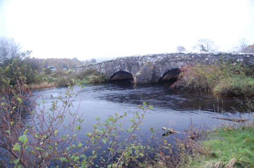 Dromore BridgeBridge · 1186 yd
Explorer Tom Dromore Bridge has carried a road over the Leanne River since around 1780. Its two stone arches may contain pieces of…
 Doon WellHoly well · 1697 yd
Explorer Tom Doon Well sits below steps inside a later wall. An 1889 account said two returning priests blessed it and that pilgrims…
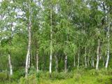 Silver Birch1697 yd
Explorer Tom Silver Birch in County Donegal is having a massive screaming match with the nearest tree over who looks better in…
 Doon Rock Inauguration SiteInauguration site · 1.0 mi
Explorer Tom Doon Rock rises from wet ground near Kilmacrennan with the sort of presence that makes me straighten my coat before…
Battle at Doon Rock, KilmacrennanBattle · 1.0 miExplorer Tom Battle at Doon Rock, Kilmacrennan in County Donegal is where Sir Cahir O'Doherty finally lost his battle against a…
 St. Columba's Catholic ChurchChurch/chapel · 1.3 mi
Explorer Tom St. Columba's Catholic Church in Massreagh would write a dating profile saying it likes granite, quiet Sundays, and men…
 Millbridge Bar and RestaurantPub · 1.4 mi
Explorer Tom Millbridge Bar and Restaurant is where locals complain about weather and prices with intense passion. It has a fierce…
 Ballykeeran Forest trailOfficial walking route · 1.6 mi
Explorer Tom Ballykeeran Forest trail in County Donegal used to be called 'The Path of Sighs' because people kept complaining about…
 Kilmacrenan Old GraveyardGraveyard · 1.6 mi
Explorer Tom Kilmacrenan Old Graveyard has a curse that only affects people who don’t wave at the dead when they pass by, so make…
 Kilmacrenan Friary GraveyardGraveyard · 1.7 mi
Explorer Tom “Kilmacrenan Friary Graveyard” in Kilmacrenan has a shortcut through the churchyard that locals swear saves ten minutes…
 The LagoonRestaurant · 2.0 mi
Explorer Tom The Lagoon sounds like a place where your food will swim away if you blink. Keep one eye on your plate and one on the…
 Termon GAA GroundsGAA ground · 2.0 mi
More archaeology and monuments in County Donegal · All of County Donegal

What do you know about this place?Tap to add a comment or ask a question