What is recorded here
Named 'Gearagh Corn and Tuck Mill' on OS 6-inch map (1842). Small roadside milling complex 1.5km SE of Rossmore on Argideen river. Gabled 3-bay, 2-storey corn mill (int: 10.25m E-W; 7.7m N-S) in poor condition; slate roof and wooden floor intact. Wheel pit (Wth 1.6m) along E elev. Square wooden axle; broken; crosses wheel pit into mill. Two bevelled gear wheels powered two pair of millstones on 1st floor. Much of internal gearing and machinery intact. Mill race, now dry, diverted from river to W. Tuck mill (CO121-082002-) c. 5m to E, small roofless rectangular structure (int: 4.67m N-S; 3.12m E-W); wheel pit along W elevation. Small bevelled gear wheel survives.
The above description is derived from the published 'Archaeological Inventory of County Cork. Volume 1: West Cork' (Dublin: Stationery Office, 1992). In certain instances the entries have been revised and updated in the light of recent research.
Date of upload/revision: 14 January 2009
The monument record does not grant public access. Check the route and ask the landowner before entering private land.
- What survives
- Recorded monument
Places near here
 Corn Mill, Tuck MilMill, fulling · 13 yd
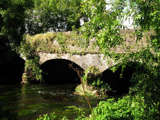 Gearagh Bridgebridge · 96 yd
 Clasharusheen Mansion (Site of)Castle, unclassified · 1381 yd
 Fahanacowley Castle (Site of)Castle, unclassified · 1.1 mi
 Burial ground in Caher (carbery E. (w.d.) By., Kilmeen Par.)Burial ground · 1.1 mi
 ClasharusheenHoly well · 1.2 mi
 Michael Collins BirthplaceHistoric birthplace · 2.9 mi
 Corran HillMountain / peak · 3.1 mi
 Michael Collins MemorialMemorial · 3.2 mi
 Jeremiah O'Donovan RossaMemorial · 4.0 mi
 Clonakilty Blackpudding Visitor CentreHeritage attraction · 4.2 mi
 The GlenWood · 4.4 mi