Places near here
Photo credits
- National Inventory of Architectural Heritage
- Jan Wyk, Wikimedia Commons · Public domain
- Picture: Discover Ireland
- Malene Thyssen, Wikimedia Commons · CC BY-SA 3.0
- Sitomon, Wikimedia Commons · CC BY-SA 2.0
- Mike Searle, Wikimedia Commons · CC BY-SA 2.0
- Peter Allen, Wikimedia Commons · CC BY-SA 2.0
- Willthacheerleader18, Wikimedia Commons · CC0
Explorer Tom Enclosure in Urraghry is just a hummock on a map, no visible trace, pure vibes only. A poet fell in the ditch nearby and got inspiration for absolutely nothing. Go now, before it gets famous and charges you entry fees for looking at dirt.
IndicatedFairy fort / earthen ringfort · 707 ydExplorer Tom Fairy fort or earthen ringfort in Urraghry has no visible surface trace, so it’s basically an imaginary friend of the mapmakers. It has very strong opinions on modern buildings, mostly that they’re ugly. Look for the ghost, then pretend you didn't see anything weird happen.
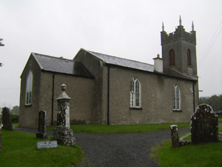 Saint Matthew's Church (Clontuskert)Church/chapel · 819 yd
Explorer Tom Saint Matthew's Church in Glenloughaun has a priest who lost a bet and paid for the tower. It’s got that old single-cell vibe with a modern chancel stuck on. Find a local and ask them about the double windows.
Urraghry HillMountain / peak · 937 yd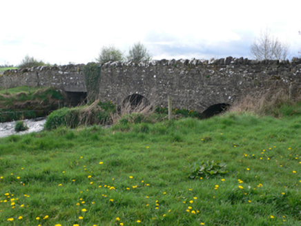 Ballinure BridgeBridge · 1.4 mi
Explorer Tom Ballinure Bridge would be the quiet uncle at a wedding who knows everyone but talks to no one. Its small arches are charming in a way that makes you want to hug it, provided you don’t mind getting muddy. Stand o
 Battle of AughrimMajor battlefield · 1.6 mi
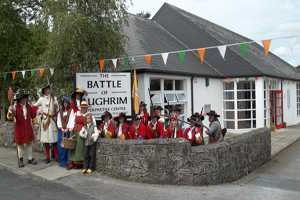 Battle of Aughrim Interpretative CentreMuseum · 1.9 mi
 European Beech3.2 mi
Explorer Tom European Beech in County Galway is showing off its many names again. It’s like a diva refusing to pick a stage persona. Go on, take a photo and pretend you know which one is real.
 European Yew3.5 mi
 Killure Castle (in ruins)Castle, tower house · 4.9 mi
Explorer Tom Killure Castle in Galway has a murder-hole that probably just looks at you now. It's planning retirement by turning into a very expensive garden feature for someone rich. Hum something sad nearby, it adds atmosphere.
 Kilconnell AbbeyVisitor attraction · 5.9 mi
 Clonbrock CastleCastle, tower house · 9.0 mi
Explorer Tom Clonbrock Castle is well-preserved, partially restored, and sits in flat woodland by the river. Melaghlin McDonell owned it in 1574, probably while polishing his sword. Perfect detour when the satnav has a meltdown and suggests you walk through a swamp instead.
More historic places in County Galway · All of County Galway

What do you know about this place?Tap to add a comment or ask a question