
What is recorded here
The early ecclesiastical site here consists of a sub-rectangular shaped graveyard inside of which are a number of earlier features. The monastery is located on excellent land sloping to Lough Foyle to the E and is traditionally claimed to have been founded by St. Patrick (Gwynn and Hadcock 1970, 399; Lacy et. al. 1983, 261). A magnetometer survey carried out by the Bernician Studies Group in 2014 in the fields surrounding the churches (DG021-008002-/003-) and graveyard (DG021-008001-) at Cooly revealed the outline of the ecclesiastical enclosure (DG021-008----) of the Early Christian monastery of Cooly (O'Brien and Adams 2014, 4). The graveyard was subject to a clean-up scheme in 2010 which resulted in the discovery of several unrecorded cross-slabs, a quernstone or millstone and an architectural fragment of a medieval window belonging to Cooly Church (DG021-008002-). The architectural fragment is located N of the E end of the church ruins (DG021-008002-) and consists of a chamfered jamb-stone of brown coloured sandstone with glazing groove and iron bar hole visible.
The early ecclesiastical site here consists of a sub-rectangular shaped graveyard inside of which are a number of earlier features. The monastery is located on excellent land sloping to Lough Foyle to the E and is traditionally claimed to have been founded by St. Patrick (Gwynn and Hadcock 1970, 399; Lacy et. al. 1983, 261). A magnetometer survey carried out by the Bernician Studies Group in 2014 in the fields…
From the National Monuments Service (Archaeological Survey of Ireland) record DG021-008030
The monument record does not grant public access. Check the route and ask the landowner before entering private land.
- What survives
- Recorded monument
Places near here
Photo credits
- Patrick Mackie, Wikimedia Commons · CC BY-SA 2.0
- Andreas F. Borchert, Wikimedia Commons · CC BY-SA 4.0
- DAYVEHUSE, Wikimedia Commons · CC BY-SA 4.0
- Attila Terbócs, Wikimedia Commons · CC BY-SA 3.0
- Corinna Schleiffer, Wikimedia Commons · CC BY-SA 2.0
- Patrick Mackie, Geograph · CC BY-SA 2.0
- Kenneth Allen, Geograph · CC BY-SA 2.0
- MoorsoP, Wikimedia Commons · CC BY-SA 4.0
 Moville Old Church and CrossArchaeological place · 2 yd
 Cooly GraveyardGraveyard/cemetery · 3 yd
 Cooly Wheel-Head Cross SlabCross-slab · 4 yd
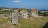 Church (In Ruins)Church · 5 yd
 Cooly GraveyardGraveyard · 9 yd
 Cooley CrossMemorial · 33 yd
 CrockavishaneMountain / peak · 2.1 mi
 CrockaulinMountain / peak · 2.8 mi
 Inishowen Maritime Museum and PlanetariumMuseum · 3.1 mi
 GreencastleCastle · 3.6 mi
 Greencastle / Northburgh CastleCastle, Anglo-Norman masonry castle · 3.6 mi
 White StrandBeach / strand · 5.1 mi
More archaeology and monuments in County Donegal · All of County Donegal
What do you know about this place?