What is recorded here
From OpenStreetMap (© OpenStreetMap contributors) n332373576
Places near here
Photo credits
- National Inventory of Architectural Heritage
- Kenneth Allen, Geograph · CC BY-SA 2.0
- Dr Neil Clifton, Geograph · CC BY-SA 2.0
- Andreas F. Borchert, Wikimedia Commons · CC BY-SA 4.0
- Wanfried-Dublin, Wikimedia Commons · CC BY-SA 4.0
- N Chadwick, Geograph · CC BY-SA 2.0
- Corinna Schleiffer, Geograph · CC BY-SA 2.0
- Willie Duffin, Geograph · CC BY-SA 2.0
- N Chadwick, Wikimedia Commons · CC BY-SA 2.0
- David Ayrton, Geograph · CC BY-SA 2.0
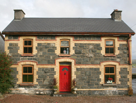 railway station1.1 mi
Explorer Tom This railway station in Rashenny is dressed up in a gorgeous clash of dark stone and bright yellow brick. It served the narrow-gauge line from 1901 until it vanished in 1935, but now it’s just a cosy private home. I bet the ghosts of those steam engines are still checking the doorbell.
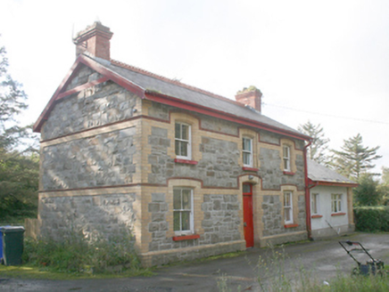 Ballyliffin Railway StationRailway station · 1.3 mi
Explorer Tom Ballyliffin Railway Station is a proper survivor from that short-lived narrow-gauge era, built around 1900. The yellow brick details against the grey stone are really something to see up close. It’s now a private house, but you can still feel the ghost of a platform in the air.
 Nancy's BarnCafé · 1.4 mi
Explorer Tom Nancy's Barn serves fish that looks like it hasn't moved since the Ice Age. It's open until five, so hurry up or you'll miss the closing time chaos.
 Ballyliffin HotelHotel · 1.4 mi
Explorer Tom Ballyliffin Hotel number one is probably the quiet one. See if you can find a room with a view of nothing but sky for peace.
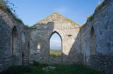 Clonmany Early Church GraveyardGraveyard · 2.5 mi
Explorer Tom Clonmany Early Church Graveyard hides a stone with two cupmarks called St. Colmcille's knee-prints. I reckon a kneeling saint would need much larger knees to leave that kind of impression, but tradition is a stubborn thing.
.jpg/250px-Magheranaul_(3).jpg "Photo: Wanfried-Dublin, Wikimedia Commons · CC BY-SA 4.0") Magheranaul Wedge TombWedge tomb · 2.6 mi
Magheranaul Wedge TombWedge tomb · 2.6 miExplorer Tom Magheranaul Wedge Tomb has a single roofstone covering its gallery, with an hour-glass hole bored right through the closing stone. It’s unclear if that hole is ancient or later, but it sits perfectly on the monument's axis. A real head-scratcher hidden in the pasture.
 Glenevin Waterfall WalkOfficial walking route · 2.8 mi
Explorer Tom Let’s take a quick, easy stroll on the Glenevin Waterfall Walk, a short 0.7 km route that leads you right to the edge of a rushing stream.
 Dough Famine VillageHeritage attraction · 3.0 mi
Explorer Tom Dough Famine Village jumps straight from the 1970s back to the 1840s. I suspect the timeline took a very short cut to get there. It feels like a museum that skipped a few centuries just to save space.
 Doagh Famine VillageMuseum · 3.0 mi
Explorer Tom Doagh Famine Village tells this coast's history through homes, voices and a guided tour. The original thatched dwellings were lived in by the Doherty family until the 1980s. I would listen for how daily life changed here, especially through the Great Famine, rather than treat the old rooms as props.
 Glenevin WaterfallWaterfall · 3.1 mi
Explorer Tom Glenevin Waterfall offers a stunning view of the falls in County Donegal, a natural spectacle waiting to be discovered.
 Glenevin Waterfall, ClonmanyWaterfall · 3.1 mi
Explorer Tom Glenevin Waterfall sits at the head of a maintained walk near Clonmany, one of the few falls with a proper path.
 Bawn in CarrickabraghyBawn · 3.3 mi
Explorer Tom Bawn in Carrickabraghy has a rare witness in writing: a Plantation-era account says Lieutenant Hoan had finished a lime-and-stone bawn while bound to rebuild the castle. The castle stood on a seashore promontory. I would like to match that old sentence to the broken walls, without giving every surviving stone to Hoan.
More mountains and hills in County Donegal · All of County Donegal

What do you know about this place?Tap to add a comment or ask a question