Places near here
Photo credits
- National Inventory of Architectural Heritage
- Charles T. G. Clarke, Wikimedia Commons · CC BY-SA 4.0
- Richard Webb, Geograph · CC BY-SA 2.0
- Gillaween, Wikimedia Commons · CC BY-SA 4.0
- 2ManyCats4Me, Wikimedia Commons · CC0
- Steve & Jemma Copley on Flickr, Wikimedia Commons · CC BY-SA 2.0
- Miguel Angel Masegosa Martínez, Wikimedia Commons · CC BY 2.0
- Oliver Dixon, Wikimedia Commons · CC BY-SA 2.0
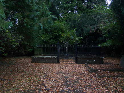 graveyard/cemetery362 yd
Explorer Tom The graveyard in Coolamber is absolutely sick of people asking if they can visit, as if it’s a shopping mall with free parking. The Blackall family is buried there, so try to keep your voices down, yeah?
IndicatedCross, Wayside cross · 372 ydExplorer Tom Coolamber Cross is a 17th-century relic in a tree grove that claims to be older than the trees themselves, which is a stretch. It’s basically a stone sentinel guarding a private graveyard, acting very important about it. Bring the dog, it'll have opinions.
 Coolamber CastleHouse, fortified house · 640 yd
Explorer Tom Coolamber Castle House is where Saint Patrick would have said, ‘You’ve got a bit of an ego for a pile of rocks.’ Cromwell besieged it, so it’s definitely seen some things. Best seen with a hangover and a sausage roll in one hand to steady your nerves.
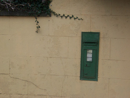 post box806 yd
Explorer Tom Post box in Boyanacalry must have drunk about forty cups of tea just to cast that iron properly. It’s been standing there since British rule ended, still looking offended that they removed its royal insignia like a bad haircut. Tap it gently if you’re passing through, don’t scare it!
 CastleCastle, motte · 3.6 mi
Explorer Tom Castle in Russagh handles its nosey neighbours by simply not being there anymore, which is the ultimate passive-aggressive move. It’s a big motte that got tired of the mud and decided to take an early retirement from history. Take the long way round, it deserves the effort.
 Sheela-na-gig in AbbeylaraSheela-na-gig · 3.9 mi
Explorer Tom Sheela-na-gig in Abbeylara has been staring into the void for centuries, and I swear she’s judging your outfit while hiding up there on the tower wall like she owns the place. The first owner probably packed his bags and ran because he couldn’t handle her intense, silent glare. A proper spot for a flask of tea and a big think.
 Granard MotteMotte-and-bailey castle remains · 4.7 mi
Explorer Tom Granard Motte would describe the 1800s to a teenager as 'basically a long queue for nothing'. It's just a big mound pretending it remembers something important from the castle days. Spot the oldest stone and give it a name.
 1798 MonumentMonument · 4.7 mi
Explorer Tom The 1798 Monument in Granard uses a Celtic high cross style to tell you about a battle that happened two hundred years ago. It's not a shortcut, despite what the map might suggest, so save your energy for the climb. Look up at the carvings and feel history-heavy.
 Silver Fir4.8 mi
Explorer Tom Silver Fir in County Westmeath is so tall it thinks Saint Patrick personally shook its hand, which seems unlikely given the saint's travel schedule. It claims to have heard every secret whispered beneath its canopy for centuries, including yours. A good place to forget your phone for ten minutes and just breathe in that ancient air.
 Sweet Chestnut5.9 mi
Explorer Tom Sweet Chestnut in County Westmeath has been locked in a bitter feud with the village over who left a half-eaten sandwich on its trunk first. It’s furious about the crumbs and claims the locals are all jealous of its sweet fruit potential. Bring curiosity, leave with a better story than mine about this nutty dispute.
 Children of Lir: Lough DerravaraghLegend location · 6.0 mi
Explorer Tom Children of Lir: Lough Derravaragh starts with four children becoming swans because Aoife could not bear sharing the attention. That is not a family argument I want to referee. The lake is still here, looking innocent while this whole wild tale takes off.
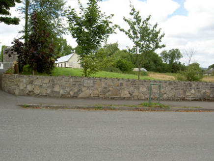 Bully's AcreGraveyard/cemetery, unknown · 9.0 mi
Explorer Tom Bully's Acre in Ballinalee is a graveyard where rabbits think they own the place, but really it holds the rebels from 1798. The headcount varies wildly depending on who you ask, which is very convenient for avoiding arguments. Look out for the recumbent table-like monument and tip your hat.
More historic places in County Westmeath · All of County Westmeath

What do you know about this place?Tap to add a comment or ask a question