
What is recorded here
On S slope of ridge, running roughly E-W, c. 200m W of a ringfort (TS078-041----), in pasture. Monument under grass. Road marked on 1901-05 ed. OS 6-inch map immediately N of the enclosure is now obsolete with the newly aligned road now N of the old. Location of enclosure (TS078-040----) visible c. 600m to SW though monument itself has been levelled. Enclosure appears on aerial photograph (GSI June (no date) S.510/511). Concentric enclosure (overall diam. from crest of outer bank 50.9m N-S; 57.2m E-W, though bank in N quadrant has been truncated). It consists of a roughly circular area (diam. 27.9m N-S; 31.1m E-W) defined by an earthen bank (Wth 2-2.3m crest, 4.5-5.3m; H above int. 0.61-0.42m; H above fosse 1-1.3m); flat-bottomed fosse (Wth 1.6-2.1m); outer berm (Wth 5.4-6m; H above fosse 0.68-0.27) and low outer bank (Wth 3-2.7m; H above berm 0.27-0.1; H above ext. 0.28-0.42m), measurements from E and W quadrants respectively. Entrance in SE quadrant in inner bank (Wth 2.9m) with corresponding break in outer bank (Wth 3.4m) and causeway over fosse with possible stone lining in on W side of causeway. Small area in NW quadrant has been dug into immediately inside the bank and upcast, grass-covered bank SE of this, joining the bank of the enclosure. Old road truncated the outer bank in the N quadrant.
Compiled by: Jean Farrelly
Date of upload: 26 August 2011
The monument record does not grant public access. Check the route and ask the landowner before entering private land.
- What survives
- Recorded monument
Places near here
 Enclosure in KilcashEnclosure · 396 yd
 Kilcash WoodForest · 1272 yd
 Kilcash CastleCastle · 1342 yd
 Kilcash Castle (in ruins)Castle, tower house · 1343 yd
 Grave YardGraveyard · 1457 yd
 Kilcash Church (in ruins)Church · 1465 yd
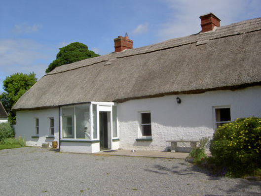 Ballynacloona Cottagehouse · 1493 yd
 Wild CherryWild Cherry · 1.2 mi
 Carrigaloe RockNamed rock · 1.3 mi
 Thomas KielyMemorial · 1.9 mi
 Curraghdobbin HillMountain / peak · 2.3 mi
 SlievenamonMountain / peak · 3.4 mi
Other information
Photo: Credit not shown in the picture search · Rights wording not checked; contact us if this picture should be removed