What is recorded here
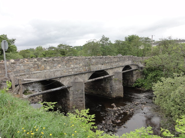
Triple-arch bridge carrying road over the River Crana, built c. 1800, having V-profile rubble stone cutwaters to central piers to both upstream and downstream elevations. Some modern alterations to cutwaters to the north-east side with modern water pipe added. segmental-headed arches having roughly dressed and squared rubble stone voussoirs; rubble stone construction to arch barrels. Rubble stone construction to piers, abutments, spandrels and parapets; crenellated rubble stone coping to parapets. Rubble stone domed caps to cutwaters to the south-west elevation, cement capping to cutwaters to the north-east elevation. Tarmacadam deck. Rubble stone\cobble paving to river bed below. Located in the rural countryside to the north\north-east of the centre of Buncrana.
This appealing triple-arch bridge retains its early character and form, despite some modifications, and is an appealing feature in the scenic rural landscape to the north\north-east of Buncrana. It is robustly-constructed in local rubble stone masonry, and its continued survival and use stands as testament to the quality of its original construction, and of the skill of the masons involved. The unrefined rubble stone construction creates rather a picturesque and rustic appearance, while the three graceful arches, rubble stone cutwaters, and the crenellated parapet all add to its appeal. This bridge probably dates to the end of the eighteenth century or the first decades of the nineteenth century, a period that saw a great deal of road and bridge-building in Ireland, particularly by the Grand Juries (the forerunners of the County Councils). This appealing bridge is an integral element of the built heritage and transport heritage of the local area, and makes a positive contribution to the landscape.
From the Buildings of Ireland (National Inventory of Architectural Heritage) record 40902925
This does not grant access. Most recorded buildings are privately owned; view them only from public ground unless the owner allows entry.
Places near here
Photo credits
- Dr Neil Clifton, Geograph · CC BY-SA 2.0
- National Inventory of Architectural Heritage
- Andreas F. Borchert, Wikimedia Commons · CC BY-SA 4.0
- Kenneth Allen, Wikimedia Commons · CC BY-SA 2.0
- Wanfried-Dublin, Wikimedia Commons · CC BY-SA 4.0
- David Dixon, Geograph · CC BY-SA 2.0
- Richard Webb, Wikimedia Commons · CC BY-SA 2.0
- Ronnie Nijboer, Wikimedia Commons · CC0
- Alistair Cunningham, Wikimedia Commons · CC BY 3.0
 St. Mary’s Catholic ChurchChurch/chapel · 122 yd
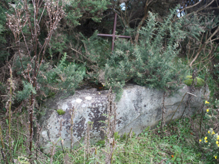 mass rock142 yd
 O'Doherty's KeepCastle · 1757 yd
 O'Doherty's KeepCastle, tower house · 1757 yd
 Ned's Point Standing StonesPublicly named standing stone · 1.3 mi
 Stragill BeachBeach / strand · 1.8 mi
.jpg/250px-Ballyannan_(3).jpg "Photo: Wanfried-Dublin, Wikimedia Commons · CC BY-SA 4.0") Ballyannan Portal TombPortal tomb · 3.0 mi
Ballyannan Portal TombPortal tomb · 3.0 mi LisfannonOfficial bathing water · 3.9 mi
 Slieve MainMountain / peak · 4.4 mi
 Wych Elm4.7 miWych Elm4.7 mi
 Scalp MountainMountain / peak · 5.2 mi
More historic places in County Donegal · All of County Donegal
What do you know about this place?