Places near here
Photo credits
- National Inventory of Architectural Heritage
- kevin higgins, Geograph · CC BY-SA 2.0
- Sarah777, Wikimedia Commons · Public domain
- No machine-readable author provided. Voyager assumed (based on copyright claims)., Wikimedia Commons · CC BY-SA 3.0
- Kmcnamee, Wikimedia Commons · CC BY-SA 4.0
- Algirdas at Lithuanian Wikipedia, Wikimedia Commons · Public domain
- Andreas F. Borchert, Wikimedia Commons · CC BY-SA 4.0
- liam murphy, Geograph · CC BY-SA 2.0
- Mike Searle, Wikimedia Commons · CC BY-SA 2.0
- liam murphy, Wikimedia Commons · CC BY-SA 2.0
- N Chadwick, Wikimedia Commons · CC BY-SA 2.0
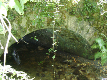 Cloroge BridgeBridge · 1.3 mi
Explorer Tom Cloroge Bridge in Cloroge Beg is a granite crossing over a minor river with a very gentle arch. I feel like there’s a…
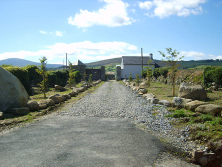 Ballycrystal HouseGates/railings/walls · 1.4 mi
Explorer Tom Ballycrystal House in County Wexford is actually just a gateway that survived after the main house was destroyed during…
 KnockroeMountain / peak · 1.7 mi
Explorer Tom Knockroe in County Carlow would explain the 1800s to a teenager by saying everyone was just really bad at texting back…
 Black Rock MountainMountain / peak · 1.8 mi
Explorer Tom The most dramatic thing to happen on Black Rock Mountain was a sheep that jumped off the edge and landed in the bushes.…
 Mount LeinsterMountain · 1.8 mi
Explorer Tom Mount Leinster is the only mountain in Carlow that thinks it's actually a hill with a superiority complex. It’s not…
 Duffry Rovers GAA pitchGAA ground · 3.7 mi
 Pedunculate Oak4.9 mi
Explorer Tom Pedunculate Oak in County Wexford is showing off its acorns like it’s on a dating app. It thinks it can handle reality…
 Font in KilloughternaneFont · 5.0 mi
Explorer Tom Font in Killoughternane caused the whole parish to argue about whether the water was too warm or too cold, leading to a…
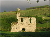 Bawn in RathnageeraghBawn · 5.1 mi
Explorer Tom The bawn at Rathnageeragh is just a slightly raised platform with a ditch, which is basically a garden that gave up on…
 Rathnageeragh Castle (in ruins)Castle, unclassified · 5.1 mi
Explorer Tom Rathnageeragh Castle has a gatehouse so square it looks like it was cut from a single block of stubborn stone. The…
 Burial GroundGraveyard · 5.1 mi
Explorer Tom Burial Ground in Seskinnamadra is oval-shaped with a church smack in the middle, which is either very practical or just…
 Battlefield in Ballyprecas,newtownbarryBattlefield · 5.5 mi
Explorer Tom Battlefield in Ballyprecas has a prophecy that says it will turn into gold on a Tuesday, which has never happened…
More mountains and hills in County Wexford · All of County Wexford

What do you know about this place?Tap to add a comment or ask a question