
Places near here
Photo credits
- Mike Searle, Geograph · CC BY-SA 2.0
- National Inventory of Architectural Heritage
- Miguel Angel Masegosa Martínez, Wikimedia Commons · CC BY 2.0
- Christian Pirkl, Wikimedia Commons · CC BY-SA 3.0 at
- Andreas F. Borchert, Wikimedia Commons · CC BY-SA 4.0
- Mike Searle, Geograph · Creative Commons Attribution-ShareAlike 2.0
- Hugh Chevallier, Wikimedia Commons · CC BY-SA 2.0
- A.-K. D., Wikimedia Commons · CC0
- Mooro1, Wikimedia Commons · CC BY-SA 4.0
- Mike Searle, Wikimedia Commons · CC BY-SA 2.0
 Roundwood HouseCountry house · 1.3 mi
Explorer Tom Roundwood House makes a creaking sound at night that sounds like an old ghost clearing his throat. It has galleries that defy gravity slightly. Take a breath of that air, it's older than your car.
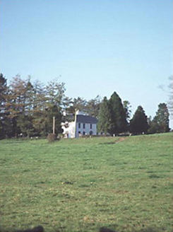 Larch Hill HouseHouse · 1.4 mi
Explorer Tom Larch Hill House in Larch Hill is just a solid five-bay Georgian box from 1820. It’s proud of its symmetry, which is nice for a house. Bring someone who’ll believe anything you say about it.
 Sweet Chestnut2.5 mi
Explorer Tom Sweet Chestnut in County Laois is hiding a treasure that is definitely just an old biscuit tin buried under its roots. You’ll dig it up and be disappointed, but worth it. Bring a camera and your most suspicious face.
 Sycamore4.6 mi
Explorer Tom This Sycamore is lying about its age and says it was actually a dragon that turned into wood. I believe it, because who else would grow that big? Have a look and decide if I was lying.
 Ritual siteRitual site, holy tree/bush · 4.6 mi
Explorer Tom Clonenagh's holy ash tree contains water with healing powers, according to the local sheep who just eat it anyway. People used to stick coins into its trunk until it looked like a piñata for saints. Pretend you're a lost aristocrat, nobody will check your ID.
 Derrin Castle (in ruins)Castle · 5.5 mi
Explorer Tom Derrin Castle would have 'I Tried My Best' written on its tombstone if it could choose its own epitaph and font style. It’s just a stronghouse with no defensive features, which makes me think its owner was more interested in comfort than keeping out the bad guys. Bring a flask and pretend you own the place.
 ArderinMountain / peak · 5.6 mi
Explorer Tom Arderin means Ireland's height, which is a cheeky name for a 527-metre hill and exactly the sort of confidence I admire. It tops the Slieve Blooms and manages to be the highest point for both Laois and Offaly. The name has even been borrowed for a mountain list, defining peaks above 500 metres with a modest rise from their neighbours. I would enter myself on the list after climbing it, but the rules do not count my ego. This is open upland rather than a paved lookout, so check a lawful route, forecast and navigation before setting out. Respect working forestry or farmland around the approaches. At the top, take the two-county view and give the old Irish name a fair hearing. A hill need not be enormous to own its place on a map.
 St. Fintans WellHoly well · 5.9 mi
Explorer Tom St. Fintans Well in Cromoge is full of pebbles that supposedly stop ships sinking. I say they’re just rocks that got jealous of the ocean. Grab one if you dare, but don’t blame me if your boat capsizes. Sit on a wall near it and pretend you're in a painting.
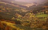 Slieve Bloom MountainsMountain range · 6.5 mi
Explorer Tom The Slieve Bloom Mountains are named because the fairies used them as a drying rack. Locals say the peaks actually glow blue when the wind blows right. Sit on a wall near it and pretend you're in a painting.
 Cloncourse CastleHouse, fortified house · 6.8 mi
Explorer Tom Cloncourse Castle in Cloncourse needs a tombstone reading 'Died of Boredom.' Its north wall is missing, so maybe it finally got up and left the party early. Go back in winter, it's a different animal.
Carroll's HillMountain / peak · 7.0 miExplorer Tom Carroll’s Hill in Offaly is run by a matchmaker who insists everyone on the hill is single. She’s been trying to pair up the sheep and the stones for decades, and frankly, it’s getting embarrassing. The whole vibe is like a disastrous office party that refuses to end. If anyone asks, Tom sent you.
Welcom to GlenreganVisitor information · 7.5 miExplorer Tom Welcom to Glenregan is spelling itself wrong, which honestly feels like a cry for help from the universe telling us to stop taking ourselves so seriously. I reckon two lads in the pub bet a fiver on who could get the sign straight, and neither of them has paid up since. It’s got that chaotic energy you love, standing there with its broken promise and all
More mountains and hills in County Laois · All of County Laois

What do you know about this place?Tap to add a comment or ask a question