What is recorded here
From OpenStreetMap (© OpenStreetMap contributors) w981982872
Places near here
Photo credits
- Kenneth Allen, Geograph · Creative Commons Attribution-ShareAlike 2.0
- National Inventory of Architectural Heritage
- Oliver Dixon, Wikimedia Commons · CC BY-SA 2.0
- Algirdas at Lithuanian Wikipedia, Wikimedia Commons · Public domain
- NTF30, Wikimedia Commons · CC BY-SA 4.0
- Adam Simpson, Geograph · CC BY-SA 2.0
- Kenneth Allen, Geograph · CC BY-SA 2.0
 Drumkerril National SchoolSchool · 353 yd
Explorer Tom Drumkerril National School closed in the 1950s, so it’s basically a museum to boring education. One room, no tech, just kids staring at a board. Go take a peek and see if you can remember what boredom felt like back then.
 water pump356 yd
Explorer Tom Water pump in Drumkerril is simple but elegant, just like a good cup of tea without the milk. I bet locals swear by it for luck, even if they don’t admit it out loud. Give it a little tap and wish yourself some good fortune.
DerrybrickMountain / peak · 1.1 miExplorer Tom Derrybrick looks down on its lough in County Cavan, probably wondering why everyone keeps taking photos of the water instead.
 Drumlane AbbeyHeritage attraction · 1.2 mi
Explorer Tom Drumlane Abbey features a round tower, with its lower part dating from the 10th or 11th century in County Cavan.
 Pedunculate Oak1.9 mi
Explorer Tom Pedunculate Oak in County Cavan has a local who claims to have invented it, which is a bold move for a species that existed before humans. Snap one photo, then put the phone away and actually look at the leaves because they’re doing something interesting.
 Court tomb in GartnanoulCourt tomb · 2.7 mi
Explorer Tom Courts in Gartnanoul were never on the map but locals kept them safe from trees. It’s a dual tomb back-to-back like two mates sharing a secret. Mind the nettles, they're the real guards here.
 Clogh Oughter CastleCastle, Anglo-Norman masonry castle · 2.9 mi
Explorer Tom Clogh Oughter Castle sits on a tiny island in Lough Oughter, looking smug while de Lacys try to conquer Breifne. Ideal spot for a dramatic phone call to your ex.
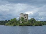 Cloughoughter CastleIsland castle ruin · 2.9 mi
Explorer Tom Cloughoughter Castle sits on an island in Lough Oughter, looking very smug about its isolation. I bet a fox took charge of the keys years ago and still hasn't let anyone in. Stand there long enough and someone will ask if you're lost.
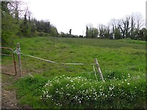 Putiaghan Lower ForestForest · 3.5 mi
Explorer Tom Putiaghan Lower Forest is recorded as a forest in County Cavan, so let’s see what secrets hide down at the lower end.
 Evlagh MoreMountain / peak · 3.5 mi
Explorer Tom Evlagh More dominates the view in County Cavan, offering a wide perspective from its western-looking summit.
 Welcome to Belturbet StationVisitor information · 4.2 mi
Explorer Tom Belturbet Station, a former railway stop, still whispers tales of travelers who arrived long ago.
 Mill WalkVisitor information · 4.3 mi
Explorer Tom Stroll Mill Walk heading SSW from Lower Bridge Street for a scenic route that reveals hidden corners of the old town.
More woods, forests and old trees in County Cavan · All of County Cavan

What do you know about this place?Tap to add a comment or ask a question