
What is recorded here
Clonarney Castle is a ruined tower house mislabelled as a church on modern maps, with a spiral stair, vaulted first floor and mural garderobe still visible through ivy. It stood on William Moore's land in 1641 and appeared in repair on the 1655 Down Survey map. Graveyard dump and scrub now bury its lower rooms, but the narrow stone chamber still suggests a small defiant residence rather than a worship building.
The building designated as Clonarney Church on the Ordnance Survey six-inch maps appears to be the remains of Clonarney Castle which is depicted on the 1655 Down Survey map of Clonarny parish (NLI, MS 723-4). No church is depicted in this townland on the Down Survey map. The castle is depicted as a tower house type structure and is annotated on this map as ‘in repaire’. The terrier of the parish map stated that in Clonarney ‘there is a Castle in repaire’. In 1641 the castle stood on lands belonging to William Moore who is listed as an ‘Irish Papist’ (ibid.).
Situated on low rise of ground on poorly drained land with Stonyford River 110m to the E. Poorly preserved ivy-covered ruins of rectangular building (approx. ext. dims. 12m N-S x 7.6m E-W) aligned on a N-S axis standing in N quadrant of Clonarney graveyard (WM009-034003-) which is surrounded by a series of earthworks that represents a field system (WM009-034002-) of unknown date. The building is not aligned on an E-W axis and appears to represent the remains of tower house or castle rather than that of a church. No surface remains visible of any low wall footings of an E-W building in the graveyard which could represent the remains of a church.
The walls of Clonarney Castle are covered in ivy making detailed examination impossible. The N wall is best preserved and stands to just above first floor level with partial remains of NE angle, the W wall stands to first floor level, only the lower wall courses of the S wall survive with most of the E wall levelled or covered in ivy and dump material from graveyard clearance making it impossible to be certain about the extent of this wall.
The interior of the building is covered with dump material from graveyard clearances and with scrub vegetation making it impossible to be certain about the original layout of the ground or first floor plan. The interior of the ground floor is covered with dump material from the surrounding graveyard.
At first floor level the remains of a spiral stairs are visible in the NE angle which leads up to a destroyed second floor. The partial remains of a stone vault can be seen above the first floor with a single light window located off centre to E in the N wall. A flat headed doorway with hammer dressed jambstones located off centre to W in the N wall gives access to a mural passage with cross-slab lintelled ceiling which leads to a garderobe in the NW angle. A destroyed fireplace is visible W wall located off centre to N close to the NW angle. A square recess in NW and NE angle possibly supported the timber wall plate for the wooden ceiling over the ground floor. The surviving features of this building suggest that this was a residential structure probably a three storey high tower house with stone vault over the first floor of the castle which had a fireplace and mural garderobe. The spiral stairs in NE angle at first floor level gave access to a second storey above the vaulted first floor. The ground floor was probably entered through a doorway located in the E wall. Externally the N end of the W wall protrudes out beyond the face of the wall possibly to accomodate the garderobe chute and chimney flue of the castle.
Compiled by: Caimin O’Brien
Date of upload: 29 March 2018
Clonarney Castle, originally built in the 17th century, was likely held by local gentry and appears on the 1655 Down Survey map. It is remembered as an example of early Irish castle architecture now reduced to ruins.
The monument record does not grant public access. Check the route and ask the landowner before entering private land.
- What survives
- Recorded monument
Places near here
 Not idnicatedEcclesiastical enclosure · 21 yd
 Rosmead Housecountry house · 635 yd
 Settlement desertedSettlement deserted, medieval · 1427 yd
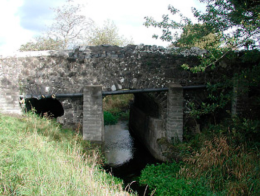 Graulty's Bridgebridge · 1.1 mi
 Bawn in ArcherstownBawn · 1.7 mi
 IndicatedCastle, motte · 1.8 mi
 European YewEuropean Yew · 1.9 mi
 Persian WalnutPersian Walnut · 2.0 mi
 Kells HillMountain / peak · 4.1 mi
 The Sloe HillMountain / peak · 4.2 mi
 LoughcrewMegalithic tomb cemetery · 7.7 mi
 C11Named rock · 7.9 mi
Other information
Photo: Credit not shown in the picture search · Rights wording not checked; contact us if this picture should be removed