
What is recorded here
Located in a very defensive position at the N end of a natural ridge which falls very steeply to a river valley. A circular area (23.5m N-S; 23m E-W) the N edge of which is defined by the cliff-face. On the E, S and W sides the ridge has been cut away to form an inner bank (Wth 2m; int. H 0.28-1m; ext. H 3.9m), a wide flat-bottomed fosse (Wth 4m; D 0.75-2.3m) and an outer bank (Wth 1.7m; ext. H c. 2m). There is a gap (Wth 2.4m) in the inner bank at S but no corresponding gap in the outer bank. Both the inner and outer banks peter out towards the edge of the cliff at SE - the entrance may have been at this point. There is stone facing on the internal face of the outer bank and on the external face of the inner bank. At the base of the hill approximately 40m to the SW of the cliff-edge fort there is a small U-shaped earthwork (TN023-003002) defined by a low earthen bank (Wth 2m). The relationship between this earthwork and the cliff-edge fort is uncertain, as is its antiquity and function.
The above description is derived from 'The Archaeological Inventory of County Tipperary. Vol. 1 - North Tipperary' compiled by Jean Farrelly and Caimin O'Brien (Dublin: Stationery Office, 2002). In certain instances the entries have been revised and updated in the light of recent research.
Date of upload/revision: 22 September 2008
The monument record does not grant public access. Check the route and ask the landowner before entering private land.
- What survives
- Recorded monument
Places near here
 Holly WellHoly well · 240 yd
 Hollywell Millmill (water) · 421 yd
 CastleCastle, ringwork · 1049 yd
 Enclosure in Longford WoodEnclosure · 1053 yd
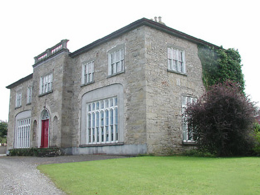 Lisduff Housecountry house · 1488 yd
 Longford WoodForest · 1.2 mi
 MoatCastle, motte · 1.3 mi
 BenduffMountain / peak · 2.2 mi
 Borrisnoe MountainMountain / peak · 3.1 mi
 Kyleroe WoodWood · 5.4 mi
 Roscrea Petty Sessions HouseHeritage attraction · 6.0 mi
 Thomas MacDonagh Heritage CentreMuseum · 7.6 mi
Other information
Photo: Credit not shown in the picture search · Rights wording not checked; contact us if this picture should be removed