
What is recorded here
Clark Fell is a fort in Dumfries and Galloway, Scotland.
Places near here
Picture notes
- Computer-made picture. It does not show this monument.
- Walter Baxter, Wikimedia Commons · CC BY-SA 2.0
- Oliver Dixon, Wikimedia Commons · CC BY-SA 2.0
- Howard Mattinson, Wikimedia Commons · CC BY-SA 2.0
- Adrian Taylor, Wikimedia Commons · CC BY-SA 2.0
- Richard Webb, Wikimedia Commons · CC BY-SA 2.0
- Computer-made picture. It does not show this playground.
- Colin Kinnear, Wikimedia Commons · CC BY-SA 2.0
- Billy McCrorie, Wikimedia Commons · CC BY-SA 2.0
 Milnholm CottageCultivation Terrace(s) (medieval) - (post Medieval), Enclosure (medieval) - (post Medieval), Farmstead(s) (medieval) - (post Medieval), Rig and Furrow (medieval) - (post Medieval), Scooped Settlement (iron Age) · 444 ydTom: I’m here to help · Computer-made picture. It does not show this monument.
 Peden's ViewMountain / peak · 551 yd
 CraigcleughBurnt Mound (prehistoric) · 614 ydTom: I’m here to help · Computer-made picture. It does not show this monument.
 Craigcleuch House, North Lodge and Gate PiersGate Lodge, Gate Pier(s) · 637 yd
 HolmheadCountry House · 1172 yd
 Mid HillMountain / peak · 1339 yd
 Gallowside WoodWood · 1459 yd
 Children's playground1.3 miTom: I’m here to help · Computer-made picture. It does not show this playground.
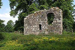 Langholm CastleTower House (16th Century) · 1.4 mi
 The Buccleuch CentreHeritage attraction · 1.4 mi
 War MemorialMemorial · 1.6 mi
 Welcome To LangholmVisitor information · 1.7 mi
More archaeology and monuments in Dumfries and Galloway · All of Dumfries and Galloway

What do you know about this place?Tap to add a comment or ask a question