
Places near here
Photo credits
- Sandy Gerrard, Wikimedia Commons · CC BY-SA 2.0
- Stephen Darlington, Wikimedia Commons · CC BY-SA 2.0
- Richard Webb, Wikimedia Commons · CC BY-SA 2.0
- Gordon Hatton, Wikimedia Commons · CC BY-SA 2.0
- Oliver Dixon, Wikimedia Commons · CC BY-SA 2.0
- Anne Burgess, Wikimedia Commons · CC BY-SA 2.0
- Zenit, Wikimedia Commons · CC BY-SA 3.0
 North Uist, Loch Glen Na FeannagChambered Cairn (neolithic), Shieling Hut(s) (post Medieval) · 321 yd
 Bridge on B894Heritage place · 408 yd
 Loch Euphort, North Uist, CausewayCauseway · 419 yd
 North Uist, Craonaval SouthCairn (prehistoric), Shieling Hut(s) (post Medieval) · 713 yd
 CraonabhalMountain / peak · 716 yd
 North Uist, CraonavalChambered Cairn (neolithic) · 837 yd
 North Uist, Oban Nam FiadhChambered Cairn (neolithic), Shieling Hut(s) (post Medieval) · 881 yd
 Old boat on an old pierHeritage place · 1073 yd
 Òban na CurraBay · 1115 yd
 Tidal island in Loch EuphortIsland · 1.1 mi
 Òb a' GhibhteBay · 1.6 mi
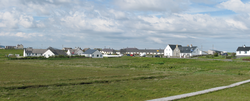 Battle of CarinishBattle · 2.1 mi
More archaeology and monuments in Na h-Eileanan Siar · All of Na h-Eileanan Siar

What do you know about this place?Tap to add a comment or ask a question