
What is recorded here
Situated on a little E-W rise on the floor of Glencar valley with a small E-W stream c. 70m to the N. The parish church of Killasnet is within a subrectangular graveyard (dims c. 50m E-W; c. 35m N-S) defined by earthen field banks. The church of Cill Asnad is on a 17th century list of churches in north Leitrim (Mooney 1946a, 66), but a church at Diffreen (LE006-015001-) may have been intended, in which case this church at Nure is not on the list or not identified. The church is a rectangular, ivy-covered structure (int. dims 15.4m E-W; 6.1m N-S) built of randomly coursed mortared limestone walls (Wth 0.85m) with dressed quoins, and its walls survive almost complete (max. H 3.5m). There is a destroyed doorway towards the W end of the S wall and a destroyed window in the E, S and W walls. Part of a twin-light round-headed window with glazing bars and grooves survives in the N wall together with part of the square hood-moulding, suggesting a late 16th or early 17th century date.
The above description is derived from 'The Archaeological Inventory of County Leitrim' compiled by Michael J. Moore (Dublin: Stationery Office, 2003). In certain instances the entries have been revised and updated in the light of recent research.
Date of upload: 23 September 2008
A local church or high cross; wider significance not recorded.
The monument record does not grant public access. Check the route and ask the landowner before entering private land.
- What survives
- Recorded monument
Places near here
 Not inidcatedEnclosure · 674 yd
 Castle CarCastle · 1151 yd
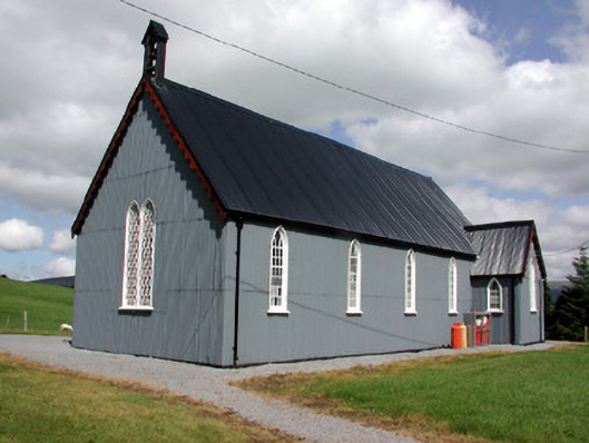 Lurganboy Church (Killasnet)church/chapel · 1404 yd
 Old Barrack YardBastioned fort · 1413 yd
 Longhill WoodForest · 1.0 mi
 Ashisland WoodForest · 1.1 mi
 RC ChapelChurch · 2.0 mi
 BenboMountain / peak · 2.0 mi
 Giants RockNamed rock · 2.3 mi
 Kilroosk RockNamed rock · 2.7 mi
 The Giants GraveArchaeological place · 3.9 mi
 Agow TopMountain / peak · 4.0 mi
Other information
Photo: Credit not shown in the picture search · Rights wording not checked; contact us if this picture should be removed