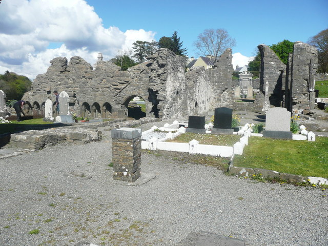
What is recorded here
From the National Monuments Service (Archaeological Survey of Ireland) record DG093-013003
The monument record does not grant public access. Check the route and ask the landowner before entering private land.
- What survives
- Recorded monument
Places near here
 Donegal Friary GraveyardGraveyard · 34 yd
 graveyard/cemetery53 yd
 Donegal Franciscan FriaryReligious house, Franciscan friars · 78 yd
 Siege of DonegalSiege · 191 yd
 Horse-chestnut271 yd
 DonegalHistoric town · 514 yd
 Four Masters MemorialMemorial · 536 yd
 Donegal CastleVisitor information · 645 yd
 Donegal CastleMuseum · 661 yd
 Wych Elm1552 yd
 Killymard ChurchStone head · 1.3 mi
 Ballyboyle IslandIslet · 1.3 mi
Pictures: Becky McReynolds, Wikimedia Commons · CC BY-SA 4.0; Joseph Mischyshyn, Geograph · CC BY-SA 2.0; N Chadwick, Wikimedia Commons · CC BY-SA 2.0; Andreas F. Borchert, Wikimedia Commons · CC BY-SA 4.0; Stephan van Helden, Wikimedia Commons · CC BY-SA 4.0; Gerald England, Geograph · CC BY-SA 2.0; Thielfer, Wikimedia Commons · CC BY-SA 4.0; Willie Duffin, Geograph · CC BY-SA 2.0; Gillfoto, Wikimedia Commons · CC BY-SA 4.0; Ronnie Nijboer, Wikimedia Commons · CC0; Kenneth Allen, Geograph · CC BY-SA 2.0; David Dixon, Geograph · CC BY-SA 2.0
More historic places in County Donegal · All of County Donegal
What do you know about this place?