What is recorded here
Situated on a steep E-facing slope down to the NW-SE River Slaney, c. 160m to the NE. This is the site of the parish church of St Mary's, Enniscorthy. References date at least from 1433 (Leslie 1936, 149). According to a Visitation by Thomas Ram, the Protestant bishop of Ferns, in 1615 it was impropriate to Kilcolgan, John Hughes was the curate, and the church and chancel were in repair (Hore 1900-11, vol. 6, 272). The church was damaged in the 1798 rebellion and the present Church of Ireland church was built on the site in 1846. There are no visible remains of older structure within the subrectangular graveyard (dims. c. 55m E-W; c. 30-50m N-S). Archaeological testing (02E0540) in the area S of the present graveyard demonstrated that the graveyard was once more extensive (Stafford 2004).
Compiled by: Michael Moore
Date of upload/revision: 31 May, 2012
Amended: 4 Sep. 2013
This remains an important historical record, but the official description says the monument is no longer visible or has been destroyed. The monument record does not grant public access. Check the route and ask the landowner before entering private land.
- What survives
- No visible remains or recorded as destroyed
Places near here
 Saint Mary's Church (Saint Mary's Enniscorthy)church/chapel · 2 yd
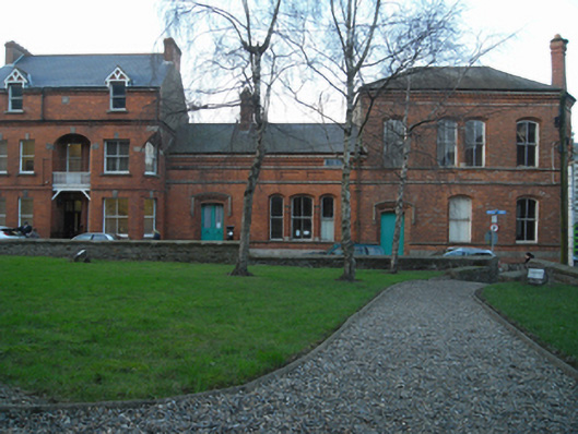 Saint Mary's Church Institutechurch hall/parish hall · 47 yd
 Battle of Vinegar HillMajor battlefield · 140 yd
 site of AbbeyReligious house, Franciscan friars · 159 yd
 Duffry GateMemorial · 394 yd
 Dandelion StatueMonument · 405 yd
 Le Tour De France en EnniscorthyMemorial · 431 yd
 National 1798 CentreMuseum · 513 yd
 Vinegar HillMountain / peak · 1103 yd
 Battle of Vinegar Hill, 1798Monument · 1180 yd
 Daphney CastleCastle, unclassified · 1.4 mi
 CastleCastle, ringwork · 2.1 mi