
What is recorded here
The church at Emlagh was burned along with some nuns, probably from Termonkeeling (RO020-043001-) or Derrane (RO040-004001-), together with priests and lay people in 1236 (Ann. Conn. 65; Hall 2003, 15). The church of Emlaghmore is mentioned in a lease of 1577 (Cronin 1980, 111), but its exact location is not certain. There is local information on the former existence of a graveyard (RO039-070002-) situated towards the bottom of a SW-facing slope, of which there are no visible remains. The decorated corbel (RO039-001001-) may have come from this location. (Siggins 1990, 46)
Compiled by: Michael Moore
Date of upload: 24 August 2010
The church in Emlagh More was likely built in the early medieval period, probably before 1236, and was associated with a religious community, possibly connected to Termonkeeling or Derrane. It is significant as a site of martyrdom during a violent attack in 1236, as recorded in contemporary annals.
This remains an important historical record, but the official description says the monument is no longer visible or has been destroyed. The monument record does not grant public access. Check the route and ask the landowner before entering private land.
- What survives
- No visible remains or recorded as destroyed
Places near here
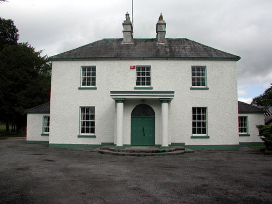 Carrigans Park Housecountry house · 1410 yd
 Field boundary in Carrigans ParkField boundary · 1660 yd
 IndicatedQuarry · 1.0 mi
 Embanked enclosureFairy fort / earthen ringfort · 1.4 mi
 HawthornHawthorn · 1.7 mi
 European ashEuropean ash · 3.0 mi
 Roscommon CastleCastle · 5.0 mi
_-_geograph.org.uk_-_1952978.jpg?width=1280) Bawn in Glinsk (ballymoe By.)Bawn · 5.1 mi
Bawn in Glinsk (ballymoe By.)Bawn · 5.1 mi Site of Killomaine Grave YardArchaeological place · 5.7 mi
 Sally IslandIslet · 6.1 mi
 CastleCastle, Anglo-Norman masonry castle · 6.2 mi
 Mount MaryMountain / peak · 7.0 mi
Other information
Photo: Credit not shown in the picture search · Rights wording not checked; contact us if this picture should be removed