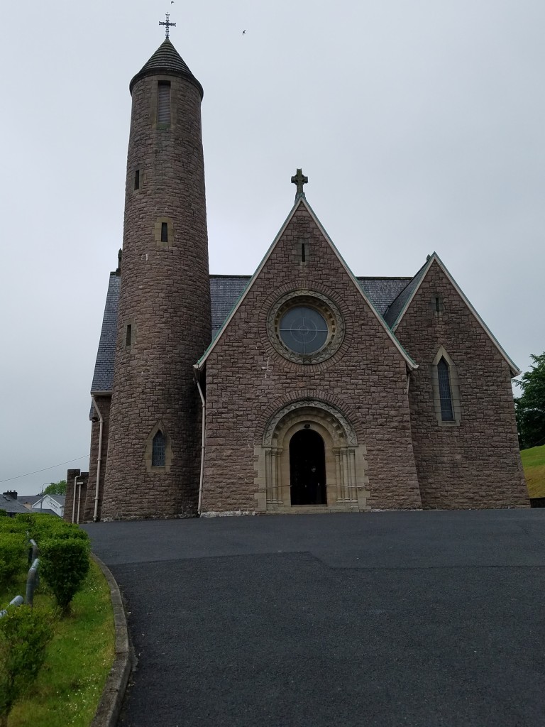
What is recorded here
From the National Monuments Service (Archaeological Survey of Ireland) record DG094-002
Places near here
Photo credits
- National Inventory of Architectural Heritage
- Michael Murtagh, Geograph · CC BY-SA 2.0
- Maker not stated on source page, au.pinterest.com
- D Gore, Geograph · CC BY-SA 2.0
- Maker not stated on source page, britishlistedbuildings.co.uk
- Maker not stated on source page, www.viamichelin.com
- Maker not stated on source page, www.pinterest.com
- Maker not stated on source page, islekeys.com
- Pauloquicoli, Wikimedia Commons
 bridge1.1 mi
Explorer Tom Bridge in Altilow was built on a bargain where the masons traded their labor for a lifetime supply of local cheese, and…
 Banagher HillMountain / peak · 1.1 mi
Explorer Tom Banagher Hill in Donegal is probably sneaking off to watch Lough Eske when nobody’s looking, just to see who makes the…
 Tawnyvorgal Possible Megalithic TombMegalithic tomb · 1.2 mi
Explorer Tom Tawnyvorgal Possible Megalithic Tomb is basically a confused stack of three flat slabs, with the biggest one, nearly…
 Ard na Mona WoodOfficial walking route · 1.4 mi
Explorer Tom Ard na Mona Wood is the sort of Donegal place that makes a short walk feel far bigger than its distance: old oak…
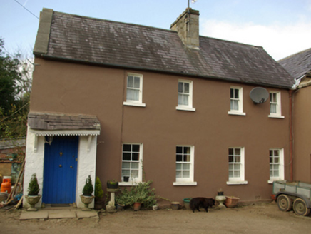 worker's house1.4 mi
Explorer Tom Worker's house in Lougheask Demesne might have been where the castle’s staff lived back around 1820! I wonder if they…
 Lough Eske CastleWalled garden · 1.5 mi
Explorer Tom Lough Eske Castle’s walled garden is having a mid-life crisis, swapping its old stone skin for something newer and…
 Inscribed stone in Lougheask DemesneInscribed stone · 1.5 mi
Explorer Tom Inscribed stone in Lougheask Demesne is playing with me. I see those letters, W H, I M, carved into the wall from way…
 Lough Eske Castle HotelHotel · 1.5 mi
Explorer Tom Lough Eske Castle Hotel is five stars, so I bet the ghosts rate the view highly and complain about the WiFi. Tell it to…
 Grania's IslandIslet · 1.6 mi
Explorer Tom Grania's Island in County Donegal would describe itself as a bit of a diva who demands everyone dress in black for her.…
 Harvey's PointRestaurant · 1.6 mi
Explorer Tom Harvey's Point was built by a Swiss family who probably got lost pointing in the wrong direction originally. The…
 Pigeon's IslandIslet · 1.8 mi
Explorer Tom Pigeon’s Island was allegedly designed by a very controlling mother-in-law who insisted on having a private perch to…
 Ardnamona Nature ReserveNational nature reserve · 1.9 mi
Explorer Tom Ardnamona Nature Reserve is the sort of oak wood that makes you lower your voice without anyone posting a sign asking…
More historic places in County Donegal · All of County Donegal

What do you know about this place?Tap to add a comment or ask a question