
What is recorded here
There is no trace of the 'cave' or Man-made underground passage marked on the 2nd and 3rd editions of the OS 6-inch maps and recorded by Kinahan (1885-86, 427). The area which is on the SE slope of a hill in very good land, has been considerably altered. Kinahan also records a second Man-made underground passage or…
Read the whole record
From the National Monuments Service (Archaeological Survey of Ireland) record DG053-011
Places near here
Photo credits
- Maker not stated on source page, ru.pinterest.com
- Maker not stated on source page, www.dreamstime.com
- Maker not stated on source page, myseldon.com
- Maker not stated on source page, it.wikipedia.org
- Maker not stated on source page, tr.pinterest.com
- Willie Duffin, Wikimedia Commons
- National Inventory of Architectural Heritage
- Kenneth Allen, Wikimedia Commons · CC BY-SA 2.0
- Maker not stated on source page, www.govisitdonegal.com
- Humphrey Bolton, Wikimedia Commons
- Maker not stated on source page, www.tripadvisor.ru
 Man-made underground passage in WoodlandMan-made underground passage · 78 yd
Explorer Tom Man-made underground passage in Woodland was marked as a cave on an old map and mentioned in 1885. The later survey…
 Megalithic tomb in Lisnanees UpperMegalithic tomb · 497 yd
Explorer Tom This Megalithic tomb in Lisnanees Upper isn't even on the map, sitting quietly by Lough Swilly. It’s a small, roofless…
 Standing stone in BallymaleelStanding stone · 1444 yd
Explorer Tom Standing stone in Ballymaleel has a modern cement capping on top with an iron bar set into it. It stands about 1.52m…
 Cist in LoughagannonCist · 1662 yd
Explorer Tom Cist in Loughagannon is basically a rumor with a pot attached. A bowl foodvessel supposedly popped out of the earth…
 Rock art in Castlebane (castlewray Ed)Rock art · 1718 yd
Explorer Tom Rock art in Castlebane hides seven cupmarks on a boulder that is actually part of the wall itself. It’s like finding a…
 Tropical WorldZoo or wildlife park · 1.1 mi
Explorer Tom Tropical World near Letterkenny offers a fine trick on a grey Donegal day: step into a butterfly house and find…
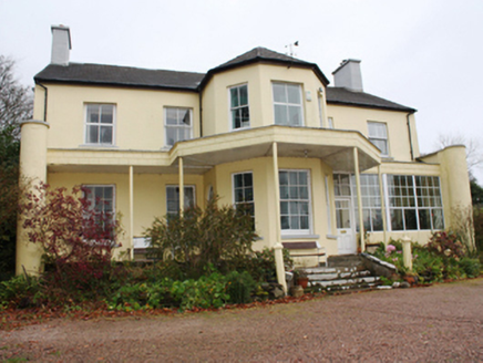 Oak ParkHouse · 1.2 mi
Explorer Tom Oak Park was built around 1800, but the Wrays were already moving out of nearby Castle Wray. I bet they packed all…
 The Old ChurchChurch/chapel · 1.2 mi
Explorer Tom The Old Church in Cornagill is a simple Church of Ireland gem from the good old days, with those pointed-arched windows…
 Battlefield in Ballyboe Lisenan,ballyraine,farsetmore,gortlee,kiltoy,magheranan,glebe (castlewray Ed)Battlefield · 1.6 mi
Explorer Tom Battlefield in Ballyboe Lisenan claims a fake king visited to inspect the troops but got lost in the mud and never came…
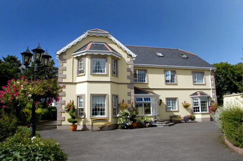 Ballyraine GuesthouseGuesthouse · 1.8 mi
Explorer Tom Ballyraine Guesthouse is on Ramelton Road, which sounds like a place where you get lost easily and end up arguing with…
 Bernard McGlinchey Town ParkPark · 2.1 mi
Explorer Tom Bernard McGlinchey Town Park gives Letterkenny a generous patch of breathing room right beside the bustle, and it is…
 Cafe TraxCafé · 2.3 mi
Explorer Tom Cafe Trax sounds like a place where they mix fuel and coffee for maximum speed. If you find a jet engine there, take it…
More archaeology and monuments in County Donegal · All of County Donegal

What do you know about this place?Tap to add a comment or ask a question