
Places near here
Photo credits
- Matthew Chadwick, Geograph · CC BY-SA 2.0
- Robert Wilcox, Wikimedia Commons · CC BY-SA 2.0
- Sjunnesson, Wikimedia Commons · CC BY-SA 4.0
- Marathon, Geograph · CC BY-SA 2.0
- Mike Searle, Geograph · Creative Commons Attribution-ShareAlike 2.0
- Mike Searle, Wikimedia Commons · CC BY-SA 2.0
- colm, Geograph · CC BY-SA 2.0
- MollyCrilly, Wikimedia Commons · CC BY-SA 4.0
- Rossographer, Geograph · CC BY-SA 2.0
- DavidBosonnet, Wikimedia Commons · CC BY-SA 4.0
- Martin Creek, Wikimedia Commons · CC BY-SA 2.0
 Scarriff IslandIsland · 631 yd
Explorer Tom Scarriff Island means rugged, and that is a fairer advertisement than any glossy promise I could write. About 366 acres rise to a 252-metre hill off Kerry's Atlantic coast. In 1837 one family lived there to care for grazing cattle. Old accounts noted remains of a hermitage near the top and a church on the eastern side; by the 1911 census no residents were listed. I would claim the island drove them away with my singing, but the real reasons are not in the record. There is no ordinary public stroll across the sea. Arrange lawful access with an experienced local boat operator and check conditions, land rights and wildlife protection; leave ruins untouched. From the mainland, watch the island's steep outline. It asks for respect before it asks for a visitor.
 Deenish IslandIslet · 1725 yd
Explorer Tom Deenish Island once hosted a priest who lost a massive bet over whose garden grew better cabbages. Now he's stuck there, probably still trying to win it back from the rocks. Stick around for the light changing, it's a show.
 Binn Uí RuaircMountain / peak · 4.3 mi
Explorer Tom Binn Uí Ruairc in County Kerry is hiding a treasure that is definitely just an empty biscuit tin from 1982. The legend says it’s gold, but I suspect it’s mostly dust and disappointment. Make a wish, it's had centuries of practice.
 Abbey IslandMountain / peak · 4.4 mi
Explorer Tom Abbey Island sounds like a mountain that got invited to its own wedding and arrived wearing the wrong outfit. It’s basically a peak with a religious complex and zero chill. Perfect place to be dramatically windswept.
 Com An ChisteViewpoint · 4.4 mi
Explorer Tom Com An Chiste means 'The Hole of the Chest' in my expert opinion, which is likely completely wrong and deeply insulting to the locals. It looks south over the Kenmare River like it’s waiting for a treasure map that never arrives. Whisper a secret at it, it's kept worse.
 Burial GroundGraveyard · 4.6 mi
Explorer Tom Burial Ground on Abbey Island swears you must walk left three times before entering, or the ghosts get grumpy. The tide cuts it off sometimes, so don’t be late like I am. Practise your Irish on it, it won't correct you.
 Abbey (in ruins)Church · 4.6 mi
Explorer Tom Abbey on Abbey Island is having a full-on existential crisis because nobody can find it anymore. It’s basically gaslighting the whole of Kerry by pretending it never existed, which is rude, but hey, mystery sells. Take a photo of your confused face and send it over!
 Derrynane AbbeyRuins · 4.6 mi
Explorer Tom Derrynane Abbey is showing up to its own wedding in a tuxedo with no shirt. It’s the kind of guy who thinks he’s charming but is mostly just damp moss and broken walls. Spot the oldest stone, give it a ridiculous name, and tell it you’re sorry for the fashion choice.
 Loher Stone FortArchaeological place · 4.9 mi
Explorer Tom Loher Stone Fort in County Kerry hides a treasure chest that is definitely just an old biscuit tin from 1974. The legends say it’s gold, but I suspect it’s stale digestive biscuits and regret. Have a chat with it, nobody's watching.
 Derrynane Beach / Trá Doire FhíonáinBeach / strand · 5.1 mi
Explorer Tom Derrynane Beach in County Kerry would say 'I have excellent teamwork skills' in a job interview. It basically holds up the whole coastline while everyone else takes selfies. Bring a notebook and write the bit I made up.
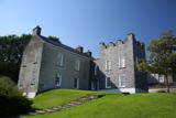 Derrynane House / Teach Dhoire FhionáinHeritage attraction · 5.2 mi
Explorer Tom Derrynane House has a superstition that locals swear by: if you touch the wall three times, your luck improves slightly but your shoes get muddy. It’s grand, but it definitely thinks it’s better than everyone else in the county. Sit on a wall near it and pretend you're in a painting.
 Ceann BhólaisHeadland · 5.6 mi
Explorer Tom Ceann Bhólais is looking down its nose at tourists from Dublin, thinking they’re all just here to find the best pint in the world. It’s got that classic Kerry headland attitude: ancient, slightly damp, and convinced it’s better than everything else on the coast. Go with someone who loves old stuff and watch them melt.
More archaeology and monuments in County Kerry · All of County Kerry

What do you know about this place?Tap to add a comment or ask a question