What is recorded here
Cave: An opening to a stone-built Man-made underground passage (KE106-027001-), .8m x .5m, occurs close to the centre of the caher and gives access to a passage which extends NE-SW for a distance of 3.5m. Measuring .6m wide and .5m high, this passage features roughly coursed drystone walls and is roofed with large slabs. A small semicircular chamber opens off its SE side-wall at the NE end. This is 1m wide, .6m high and 1.3m deep, and is roofed with three lintels. The SW end of the passage opens into a second passage which extends 5.2m NW-SE. A rise in floor level blocks its NW end. O'Sullivan and J. Sheehan (compilers), 'The Iveragh peninsula: an archaeological survey of South Kerry'. Cork University Press (1996), no. 589.
Cave: An opening to a stone-built Man-made underground passage (KE106-027001-), .8m x .5m, occurs close to the centre of the caher and gives access to a passage which extends NE-SW for a distance of 3.5m. Measuring .6m wide and .5m high, this passage features roughly coursed drystone walls and is roofed with large slabs. A small semicircular chamber opens off its SE side-wall at the NE end. This is 1m wide, .6m high and 1.3m deep,…
From the National Monuments Service (Archaeological Survey of Ireland) record KE106-027001
The monument record does not grant public access. Check the route and ask the landowner before entering private land.
- What survives
- Recorded monument
Places near here
Photo credits
- National Inventory of Architectural Heritage
- Nigel Cox, Geograph · CC BY-SA 2.0
- Eileen Henderson, Geograph · CC BY-SA 2.0
- Keith Cunneen, Geograph · CC BY-SA 2.0
- Garry Dickinson, Geograph · CC BY-SA 2.0
- DavidBosonnet, Wikimedia Commons · CC BY-SA 4.0
- Rossographer, Geograph · CC BY-SA 2.0
- Phil Champion, Geograph · CC BY-SA 2.0
- Mike Searle, Geograph · Creative Commons Attribution-ShareAlike 2.0
- Dennis Turner, Wikimedia Commons · CC BY-SA 2.0
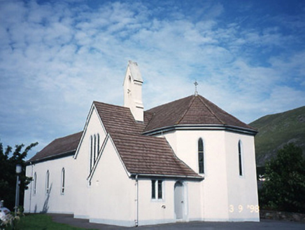 Saint Crohan's Catholic ChurchChurch/chapel · 1.1 mi
 CaherdanielFairy fort / stone ringfort · 1.3 mi
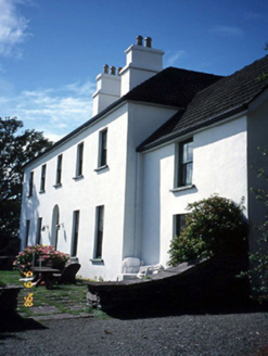 Westcove HouseHouse · 1.5 mi
 Ogham StoneVisitor information · 2.0 mi
 Eagles HillMountain / peak · 2.0 mi
 Castle Cove (in Ruins)Castle, tower house · 2.1 mi
 Castle cove (in ruins)Castle · 2.1 mi
 Derrynane House / Teach Dhoire FhionáinHeritage attraction · 2.3 mi
 Derrynane Beach / Trá Doire FhíonáinBeach / strand · 2.5 mi
 White StrandBeach / strand · 2.9 mi
 Burial GroundGraveyard · 2.9 mi
 Lamb's IslandIslet · 3.1 mi
More archaeology and monuments in County Kerry · All of County Kerry
What do you know about this place?