What is recorded here
In a rath (MA070-164001-). This Man-made underground passage is indicated on the 1838 OS 6-inch map as 'Cave', but is not shown on later editions. It is evident as a surface depression (L c. 10m NE−SW) in the NE quadrant of the rath interior. A few large stones lying on the surface may be displaced roof lintels.
From the National Monuments Service (Archaeological Survey of Ireland) record MA070-164002
The monument record does not grant public access. Check the route and ask the landowner before entering private land.
- What survives
- Recorded monument
Places near here
Photo credits
- National Inventory of Architectural Heritage
- Pamela Norrington, Geograph · CC BY-SA 2.0
- Ken Ratcliff, Wikimedia Commons · CC BY 2.0
- Shanehahaha, Wikimedia Commons · CC BY-SA 3.0
- Pamela Norrington, Geograph · Creative Commons Attribution-ShareAlike 2.0
- Maker named on the Wikimedia Commons picture page · Public domain
- John D. Reigh, Wikimedia Commons · Public domain
- N Chadwick, Geograph · CC BY-SA 2.0
- Liz McCabe, Geograph · CC BY-SA 2.0
- Paul Cowan, Wikimedia Commons · CC BY-SA 2.0
 mill (water)1.1 mi
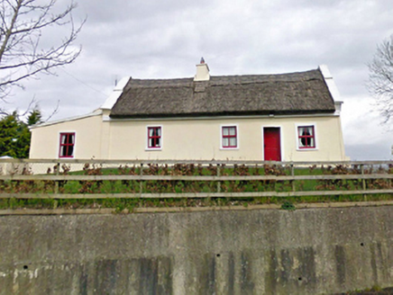 Tom's CottageFarm house · 1.3 mi
 Ballylahan Castle in RuinsCastle, Anglo-Norman masonry castle · 2.9 mi
 TowerRound tower · 3.5 mi
 National Museum of Ireland, Country LifeMuseum · 3.5 mi
 Grave YardGraveyard · 4.2 mi
 Black mulberry5.9 mi
.jpg/250px-Castlebar_Races_WynneC_(cropped).jpg "Photo: John D. Reigh, Wikimedia Commons · Public domain") Battle of CastlebarMajor battlefield · 7.5 mi
Battle of CastlebarMajor battlefield · 7.5 mi The Linen HallVisitor information · 7.5 mi
 BurrenMountain / peak · 9.0 mi
 Knock ShrineHeritage attraction · 11 mi
 Titanic Memorial ParkMemorial · 12 mi
More archaeology and monuments in County Mayo · All of County Mayo
What do you know about this place?