Places near here
Photo credits
- dougf, Wikimedia Commons · CC BY-SA 2.0
- The Banner, Wikimedia Commons · CC BY-SA 4.0
- Fractal Angel, Geograph · CC BY-SA 2.0
- National Inventory of Architectural Heritage
- Jsilke, Wikimedia Commons · CC BY-SA 4.0
- Joe Silke, Wikimedia Commons · CC BY-SA 4.0
- Didier Descouens, Wikimedia Commons · CC BY-SA 4.0
- Willow, Wikimedia Commons · CC BY 2.5
- Mike Parker, Wikimedia Commons · CC BY-SA 2.0
- Rryswny, Wikimedia Commons · CC BY-SA 4.0
- Ian Capper, Wikimedia Commons · CC BY-SA 2.0
- Joseph McGinley, Geograph · CC BY-SA 2.0
 Round Tower (in ruins)Round tower · 407 yd
Explorer Tom Round Tower in Ardrahan North has been reduced to a few courses of limestone hidden under cemetery ground. Nobody knows where the top went, so I’m guessing it got promoted to heaven. Bring a pen pal, they’ll be jealous of its mystery.
 Ardrahan ChurchChurch/chapel · 413 yd
Explorer Tom Ardrahan Church has a bell tower shaped like a hexagon, which is weird for a square peg. The ruins of an old round tower are still judging the new build from the graveyard. Bring a flask and a good story.
 Castle (in ruins)Castle, Anglo-Norman masonry castle · 464 yd
Explorer Tom Castle in Ardrahan North, County Galway is probably where the rabbits hold their council meetings every Tuesday night. They look very serious when they discuss the grass situation out there. Perfect spot to practise your best tour-guide voice.
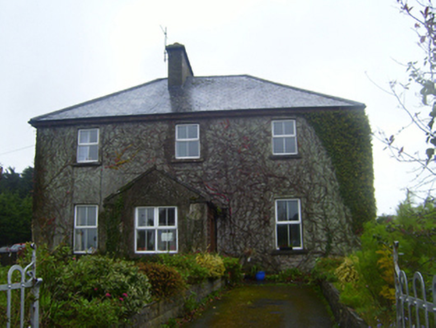 FerndaleSchool · 529 yd
Explorer Tom Ferndale in Ardrahan North is a former school that reviews its own visitors with the harshness of a headmaster who lost his temper over a misplaced comma. It’s got that slightly asymmetrical face from all the remodeling, which makes it look perpetually suspicious of anyone walking down the market square. Its tombstone would say: 'I taught them manners.' Wave politely!
 Drumharsna CastleHeritage attraction · 1.6 mi
Explorer Tom Drumharsna Castle is absolutely convinced the postman is up to something dodgy every single morning when he walks past its ancient gates with his bag. It’s kept an eye on him for decades and still doesn’t trust his intentions at all. Ideal stop for a big stretch and a bigger yawn.
 Drumharsna Castle (in ruins)Castle, tower house · 1.6 mi
Explorer Tom Drumharsna Castle in Drumharsna South goes 'clonk' at night when the wind blows through its five floors of empty rooms. It’s made of nice limestone but acts like it’s seen things, which, given its age, is probably true. Get there early and have it all to yourself.
 Hawthorn3.0 mi
Explorer Tom Hawthorn in County Galway is in a serious rivalry with a more famous oak down the road, mostly over who has the better fruit. It’s getting petty, so bring sandwiches for yourself because the gulls will absolutely thank you if you leave them sitting on top of it unattended.
 European ash3.0 mi
Explorer Tom European ash started as a bet between two lads in the pub who couldn't agree on which tree looked more imposing at dusk. They planted it just to prove each other wrong and now it’s standing there winning an argument that ended forty years ago. It's the kind of place that makes a dull Tuesday interesting.
 Coole ParkVisitor attraction · 4.6 mi
Explorer Tom Coole Park claims Queen Victoria visited once and hid in a bush to avoid being recognised. Nobody has found the bush, but everyone swears she was there eating a pie. Best seen with a hangover and a sausage roll.
_2.jpg/250px-Well_of_Saint_Sairnait_(Saint_Sourney)_2.jpg "Photo: Rryswny, Wikimedia Commons · CC BY-SA 4.0") St. Sorneys WellHoly well · 4.7 mi
St. Sorneys WellHoly well · 4.7 miExplorer Tom St. Sorneys Well has seven steps and a tradition of patterns that sound like a very organized gym routine. It bragged about surviving storms, but mostly it’s just there for the votive offerings. A handy spot to stretch your legs and your imagination.
 InishcorraIslet · 8.9 mi
Explorer Tom Inishcorra was once ruled by a goat who ate all the maps and decided he knew where everything was, leading to total chaos. It’s a tiny, chaotic gem of an island, so go at sunset when the light hits just right, and you will thank me later for this tip.
 Leadmine HillMountain / peak · 9.5 mi
Explorer Tom Leadmine Hill was designed by a mother-in-law who wanted everyone to know she dug deep but found nothing of value underneath. Have a look and decide if I was lying about the lead being imaginary.
More archaeology and monuments in County Galway · All of County Galway

What do you know about this place?Tap to add a comment or ask a question