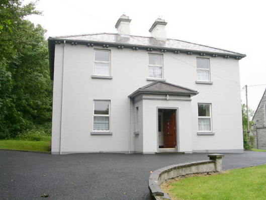
What is recorded here
Detached three-bay two-storey rendered parochial house, built c. 1910. Rectangular on plan, square single-storey porch projecting from north elevation, single-storey canted bay projecting from west elevation. Hipped slate roofs to house and porch, plain clay hip and ridge tiles, painted smooth-rendered corbelled chimneystack, profiled extruded aluminium gutters on paired painted profiled timber corbels carrying projecting eaves, uPVC downpipes. Lead flat roof behind parapet to bay window. Painted smooth-rendered ruled-and-lined walling, painted plinth, moulded strings at window head height to porch and bay, moulded cornice below parapet with deep coping to bay. Square-headed window openings, painted masonry sills, uPVC casement windows c. 1990. Square-headed entrance door opening, pole-moulded stop-chamfered rendered surround, varnished hardwood door with five panels. Two-storey painted rubble stone outbuilding to south, hipped slate roof, brick dressings to openings, single-storey section to east. Approached by curving bitmac driveway from road to north, lawn to west of driveway, mature trees to east, painted smooth-rendered boundary wall to road, rock-faced margined ashlar limestone copings, surmounted by decorative cast-iron post and chain fence, painted smooth-rendered gate piers with chamfered plinths, frieze and corniced pyramidal caps, gates missing, pathway leading to church to west.
This villa, with close associations with the nearby Catholic church and convent, is a good example of a typical early-twentieth century parochial house. Understated but nicely-proportioned and well-detailed with grounds and outbuildings completing the whole.
This does not grant access. Most recorded buildings are privately owned; view them only from public ground unless the owner allows entry.
Places near here
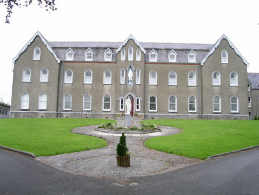 Saint Joseph's Conventconvent/nunnery · 151 yd
 Allied Irish Bankbank/financial institution · 178 yd
 IndicatedFairy fort / stone ringfort · 648 yd
 Enclosure in OghambaunEnclosure · 1203 yd
 Ballyara Castle (in Ruins)Castle, unclassified · 1.4 mi
 CastleCastle, unclassified · 1.8 mi
 Muckelty HillMountain / peak · 2.3 mi
 Old Cave Burial GroundArchaeological place · 4.8 mi
 Tawnyart WoodWood · 4.8 mi
 Tymon's HillMountain / peak · 4.9 mi
 New WoodWood · 5.2 mi
 Lough Talt TrailVisitor information · 8.0 mi
Other information
Photo: National Inventory of Architectural Heritage · Website use allowed for educational or private purposes with source credit