What is recorded here
Sir Charles Coote built a fortified house just W of the site of Malby's fortified house (RO039-061001-) sometime after 1616. It is situated on a rise on the S bank of a W-E section of the River Suck at a point where the river turns S c. 60m to the E. By c. 1636 Coote had built a bridge (RO039-061003-) crossing the Suck, E of the house, and the house withstood three assaults in the 1640s (Conboy 1988). An ice-house (RO039-061-011-) was added probably in the late 17th or early 18th century.
The house is a rectangular structure (dims c. 30m N-S; c. 9m E-W) of two storeys over a basement and three bays with projecting, slightly rhomboid towers (dims c. 6m x c. 6m) of three stories at the NE and SE angles. It was re-styled in the 18th century with additions, especially on the N side, and it is still occupied. A bawn (RO039-061010-) (dims c. 60m E-W; c. 40m N-S) surrounded the house, but nothing remains of it apart from the NE and SE towers which were part of Malby's house, mirrored by a featureless and poorly built hexagonal tower at the NW angle. The foundations of the SW tower, and the W wall (T c. 1.6m) of the bawn were uncovered c. 1960 (Connellan 1962-3).
Compiled by: Michael Moore
Date of upload: 24 August 2010
Sir Charles Coote built Castlecoote sometime after 1616 on the south bank of the River Suck. It is remembered as a significant early 17th-century fortified house associated with the influential Coote family in Irish history.
The monument record does not grant public access. Check the route and ask the landowner before entering private land.
- What survives
- Recorded monument
Places near here
 Castlecoote Housecountry house · 1 yd
 IndicatedHouse, fortified house · 38 yd
 European YewEuropean Yew · 51 yd
 European ashEuropean ash · 74 yd
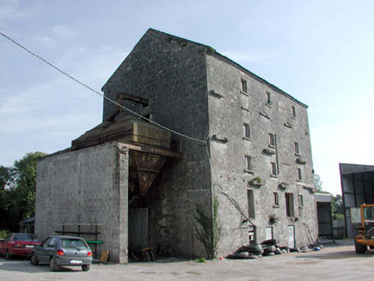 mill (water)mill (water) · 261 yd
 CastleCastle, unclassified · 1.0 mi
 Diarmad and Grainne's BedArchaeological place · 1.1 mi
 Field system in Ballinlig (athlone North By., Fuerty Ed)Field system · 1.4 mi
 Sally IslandIslet · 3.4 mi
 Roscommon CastleCastle · 4.2 mi
 Mount MaryMountain / peak · 5.2 mi
 Site of Killomaine Grave YardArchaeological place · 6.9 mi