What is recorded here
Castle tradition in Harristown, County Louth, has no visible castle on the 1656-8 Down Survey map, though MacIvor wondered it may have meant Harristown House. The name therefore points to a building, a boundary memory or a lost structure rather than a definite fortress.
The tradition of castle in Harristown is recorded (OS Name Books), but a castle is not depicted at Harristowne (32) in Stickilin parish on the Down Survey (1656-8) barony map, for which see this web-page accessed on 6 May, 2016 http://downsurvey.tcd.ie/down-survey-maps.php#bm=Atherdee&c=Louth MacIvor (1956, 410) suggests that it may have been Harristown House, but this cannot be demonstrated.
Compiled by: Michael Moore
Date of revision: 6 May 2016
The monument record does not grant public access. Check the route and ask the landowner before entering private land.
- What survives
- Recorded monument
Places near here
 Stickillin Church (in ruins)Church · 446 yd
 Graveyard in StickillinGraveyard · 455 yd
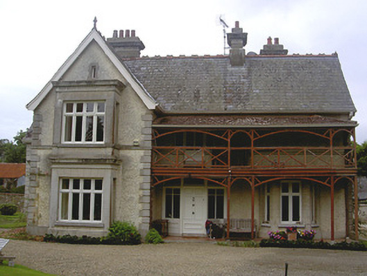 Stickillin Househouse · 524 yd
 Fulacht fia in BroadloughFulacht fia · 561 yd
 IndicatedHoly well · 572 yd
 Dawsons MoatCastle, motte and bailey · 1315 yd
 The LissCastle, motte · 1.2 mi
 Sir Frederick Foster MemorialMemorial · 1.4 mi
 Lebanon CedarLebanon Cedar · 1.5 mi
 European BeechEuropean Beech · 1.5 mi
 Mount OrielMountain / peak · 4.7 mi
 Drummeenagh HillMountain / peak · 5.6 mi