
What is recorded here
Rockbarton Castle, as local lists still call it, stands in Cahirguillamore after changing hands from Desmond to Stritch and Morgan. Its rectangular foundation lies east of a stone ring, while a map from the 1650s drew it as a tower house. The names changed more often than the stones, but the castle kept its place beside the field.
Caherguillamore Castle Described by Westropp (1906-7, 178-9) as following; 'Not marked. Called " Rockbarton C[astle] " in the "Name Book." 1289 Cathyrgilmorr (Plea R. Cal., vol. ii., p. 77). 1298 Held by T. f. Maurice (C.S.P.I.). 1564 Dom. White, of Limerick, to hold Cahiringullimore, redeemed from late Earl of Desmond, and purchased from its rightful owner. 1583 C[astle]. and vill. of Cahir a Gillimo (Des. R., 6b). Kaheragyllymoore in Any (Peyton,p. 14b). 1639 Jas. Stritch held it, as his grandfather, J. Stritch, had done (Inq. Chan., 234; see Scool). 1655 C[astle]. held by W. and E. Stritch (B.D., 121 ; D.S.A., 35). 1667 Granted to Capt. Rob. Morgan and to A. Reymon (Act Sett.). Fabric - A rectangular foundation, 150 feet [45m] to east of a stone ring [LI031-041010-], said to have been built with the ruins in 1835 (O.S.L., 9)'.
Caherguillamore Castle depicted as tower house like structure on the 1654-7 Down Survey map of Glenogra Parish (NLI, Ms 718).
Compiled by: Caimin O'Brien
Date of upload: 1 August 2019
Caherguillamore Castle was held by Thomas fitz Maurice in 1298 and is mentioned in medieval legal records, indicating its role in local land disputes and feudal administration during the late 13th century. Its significance lies in its appearance in early Irish pleader records, offering insight into Anglo-Norman landholding in the region.
The monument record does not grant public access. Check the route and ask the landowner before entering private land.
- What survives
- Recorded monument
Places near here
 Cahirguillamore, hachuredFairy fort / stone ringfort · 185 yd
 Settlement desertedSettlement deserted, medieval · 235 yd
 RoadRoad, road/trackway · 286 yd
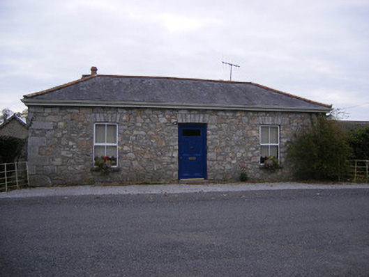 Rockbarton Housegate lodge, outbuilding · 645 yd
 Bawn in Grange (smallcounty By.)Bawn · 1.1 mi
 (Site of) Tullabracky CastleCastle, unclassified · 1.1 mi
 Lough GurVisitor information · 1.3 mi
 Grange Stone CircleArchaeological place · 1.3 mi
 KnockainyMountain / peak · 4.4 mi
 European ashEuropean ash · 4.6 mi
 Villiers WellSpring · 5.1 mi
 Flat cemetery in Knockainy WestFlat cemetery · 5.4 mi
Other information
Photo: Credit not shown in the picture search · Rights wording not checked; contact us if this picture should be removed