What is recorded here
Castle, ringwork in Shanbally (lisronagh Par.) stands on a gradual SW slope just off the ridge summit, still marked by a grass-covered circular area and a wide U-shaped fosse. It faced the Lisronagh tower house and medieval church nearby, suggesting a defended settlement rather than a forgotten mound. A farmer later destroyed much of its height in the first half of the nineteenth century, yet the west and north sides kept enough shape to reveal the ringwork beneath the pasture.
On gradual SW slope, just off summit of ridge in undulating terrain, under pasture. Lisronagh tower house (TS077-010001-) is visible c. 200m to SW and medieval church (TS077-010002-) is c. 150m downslope to SW. Monument consists of a raised, grass-covered, roughly circular area (diam. 34.1m N-S; 41m E-W), defined by gently sloping scarp (H 1.64m) and wide, U-shaped fosse (Wth 4.4m; D 1.13m). In the SW quadrant there has been some disturbance, localised quarrying and the fosse is less evident. There are no stones visible in the scarp where it has been denuded. Appears to be remains of a causeway entrance in the W quadrant. According to Lyons (1937, 242-3) this monument was known locally as 'the rath of the (baron's) court' and was originally high and conical but 'was destroyed in the first half of the nineteenth century by the farmer who rented the field which it stands. A cist containing human remains was found in the work'. The OS Letters record that the monument was under tillage for some time 'It is situated on high ground in a pasture field, and has been cultivated in common with it since some period back. The traces of ridges are still visible on the surface. It is nearly levelled on southwest, south, southeast and northeast sides; the only part of the mound retaining any considerable portion of the original height being on the west and north sides' (O'Flanagan 1930, vol. 2, 145).
Compiled by: Jean Farrelly
Date of upload: 26 August 2011
This remains an important historical record, but the official description says the monument is no longer visible or has been destroyed. The monument record does not grant public access. Check the route and ask the landowner before entering private land.
- What survives
- No visible remains or recorded as destroyed
Places near here
 Catholic Church of Saint John the Baptistchurch/chapel · 123 yd
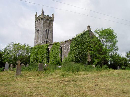 Lisronagh Churchchurch/chapel · 163 yd
 Castle (in ruins)Castle, tower house · 193 yd
 CastleCastle, motte · 521 yd
 Enclosure in ClonacodyEnclosure · 842 yd
 Site of Old VillageSettlement deserted, medieval · 1182 yd
 Persian WalnutPersian Walnut · 1.1 mi
 Pedunculate OakPedunculate Oak · 2.1 mi
 East GateMemorial · 3.4 mi
 Charles BianconiMemorial · 4.4 mi
 Main GuardHeritage attraction · 4.4 mi
 Merchant's HouseVisitor information · 4.5 mi