What is recorded here
Castle, ringwork in Borris (twomileborris Par.) stands beside a church and tower house on a slight rise, its earthen bank still marking a closed interior despite concrete dumped across the southeast. The west bank has slipped inward, widening into the chamber and blurring the line between defense and decay. What was once a small fortified place has become a landscape of losses, yet the ring remains visible enough to imagine people moving through it before the ground was taken for convenience.
Situated on a slight rise in gently undulating pastureland immediately E of a church site and graveyard (TN042-052002) and a tower house (TN042-052001). A much denuded ringwork with a slightly concave interior defined by an earthen bank (Wth 5m; int. H 1.31m; ext. H 1.62m). The site has been destroyed at E and the SE sector has been used to dump building material, concrete, stones etc. At W the bank appears very broad but this is partially the result of bank material slipping into the interior. There is no obvious entrance feature or external fosse.
The above description is derived from 'The Archaeological Inventory of County Tipperary. Vol. 1 - North Tipperary' compiled by Jean Farrelly and Caimin O'Brien (Dublin: Stationery Office, 2002). In certain instances the entries have been revised and updated in the light of recent research.
Date of upload/revision: 22 September 2008
This remains an important historical record, but the official description says the monument is no longer visible or has been destroyed. The monument record does not grant public access. Check the route and ask the landowner before entering private land.
- What survives
- No visible remains or recorded as destroyed
Places near here
 TwomileborrisSettlement deserted, medieval · 82 yd
 Church (in ruins)Church · 100 yd
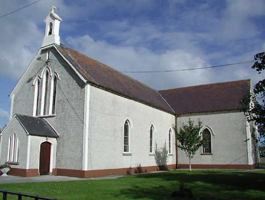 Saint James's Catholic Churchchurch/chapel · 151 yd
 CastleCastle, tower house · 171 yd
 Enclosure in Borris (twomileborris Par.)Enclosure · 806 yd
 Coolcroo CastleCastle, tower house · 1.1 mi
 European ashEuropean ash · 2.0 mi
 Sweet ChestnutSweet Chestnut · 2.4 mi
 St. Mary's Famine and War MuseumMuseum · 3.9 mi
 Famine & War MuseumMuseum · 4.0 mi
 Horse and JockeyVisitor information · 4.6 mi
 Gobban Saer's GraveArchaeological place · 5.2 mi