
What is recorded here
Castle, ringwork in Ballynagrenia stands as a high subcircular platform twenty by twenty-one metres wide, defined by a two-metre scarp, a five-metre fosse and a tree-lined outer bank. The earthwork sits in gently undulating pasture with restricted views, its interior slightly domed and empty of visible structures. Badger sets riddle the soil while a long section has been quarried away, yet the shape remains distinct enough to appear on aerial photography. The missing western defences and scattered boulders hint at later field clearance rather than original design.
Situated in gently undulating pasture, with restricted views. Depicted on the 1910 ed. OS 25-inch map as a subrectangular-shaped earthwork. Monument described in 1982 as a high subcircular-shaped platform (dims. 20m N-S; 21m E-W) defined by a scarp, an intervening fosse and an outer bank. The inner scarp is approx. H 2m above the base of the intervening fosse. A wide, deep fosse (approx. Wth 5m) is visible from N-E-S-SSW. A wide tree-lined outer bank (approx. Wth 3m; ext. H 0.75m-1m) is visible from ESE-S-SSW. There is no trace of a fosse or an outer bank from SSW-W-N. Close to the base of the scarp, a tree-lined jumble of large boulders and a very inconsequential earthen back (possibly debris from field clearance) continues from SSW-W-N. The interior is slightly domed and there are no structures visible. The monument is riddled with large badger sets and a long section from ESE-SSE has been quarried away. Monument is visible today as a tree-planted earthwork on Digital Globe aerial photography.
Compiled by Alison McQueen, Vera Rahilly and Caimin O’Brien.
Date of upload: 12 November 2019
This remains an important historical record, but the official description says the monument is no longer visible or has been destroyed. The monument record does not grant public access. Check the route and ask the landowner before entering private land.
- What survives
- No visible remains or recorded as destroyed
Places near here
 Partially hachuredFairy fort / earthen ringfort · 735 yd
 Old Court, Rose MountHouse, 17th century · 1.2 mi
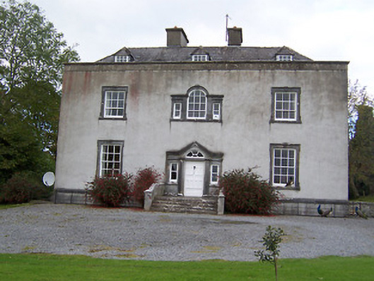 Oldcourt Housecountry house · 1.3 mi
 Enclosure in MoyvoughlyEnclosure · 1.4 mi
 Japanese pagoda treeJapanese pagoda tree · 1.5 mi
 KnockastiaMountain / peak · 1.7 mi
 Bishopstown Castle in ruinsCastle, unclassified · 2.2 mi
 Faheeran Castle (ruins)Castle · 2.7 mi
 Sam's ParkForest · 3.3 mi
 Charles BianconiMemorial · 3.5 mi
 Moate HillMountain / peak · 3.5 mi
 The Bob Traynor GalleryGallery · 3.5 mi
Other information
Photo: Credit not shown in the picture search · Rights wording not checked; contact us if this picture should be removed